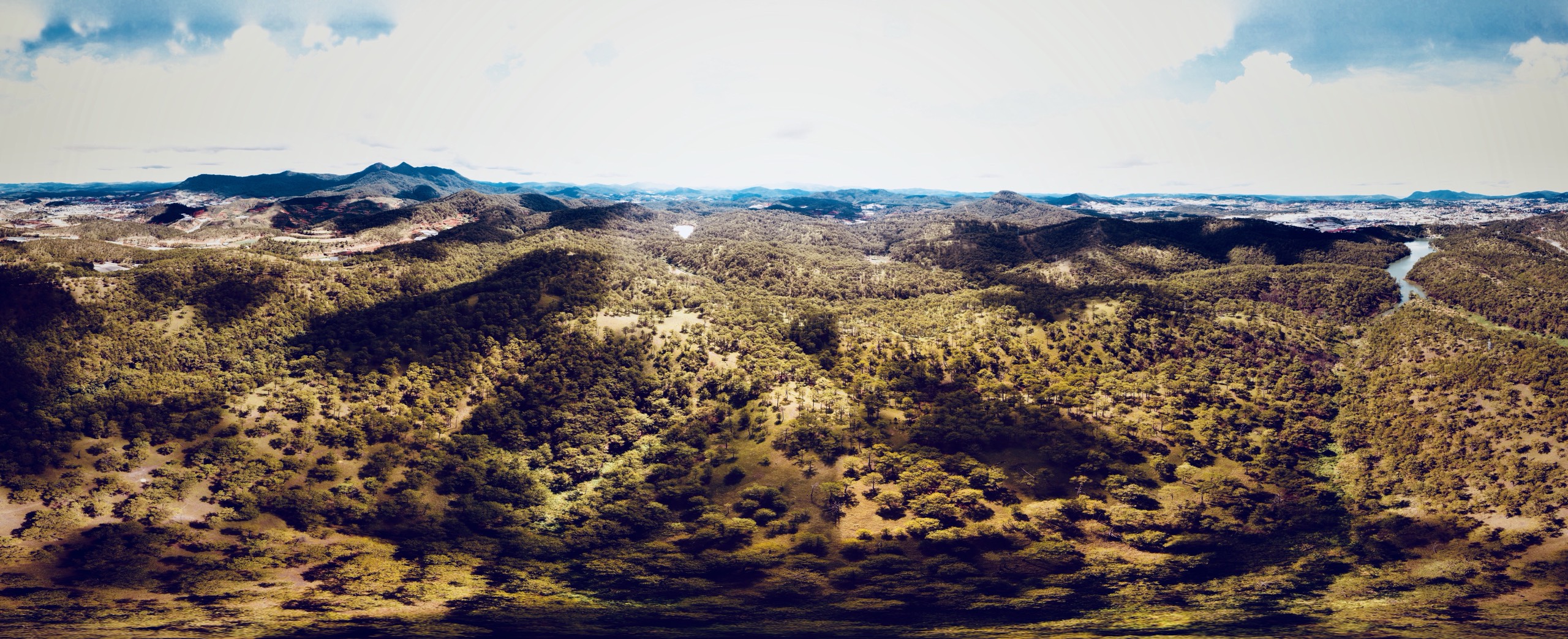
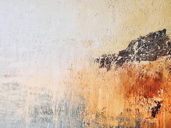
Bathing in the mist of the mountains and forests, we are like super crooked footsteps. Overconfidence has given way to humble trembling. Following the breath we look back at the decaying frame of the mythical years. I falter, bowing my head not to beg, but to apologize for the unruly bare-headed man.
Voices of nature
The melodious reverberation of the mountains and forests,
Clouds cover the rising sun,
I silently curled up in the wind,
Absorb the mist of the dawn light.
Âm vang núi rừng
Du dương vọng tiếng hoà ca rừng núi,
Mây ngập tràn che khuất mặt trời lên,
Ta lặng im cuộn mình trong làn gió,
Men hơi sương ngút ngọn ánh bình minh.
Ho Viet Vinh, Dalat 2021
Next project | Phác thảo Chiến lược Quốc gia chung sống an toàn với lũ lụt tại Huế
Phác thảo Chiến lược Quốc gia chung sống an toàn với lũ lụt tại Huế
Triết lý nền tảng: Chuyển từ tư duy “chống lũ” sang “sống chung với lũ một cách thông minh và an toàn”. Coi nước lũ là một phần của hệ sinh thái và văn hóa Huế, cần được quản lý chứ không thể triệt tiêu.
[Kiến trúc sư – Quy hoạch gia Hồ Viết Vinh]
Bốn Trụ Cột Chiến Lược chính:
1. Trụ cột quy hoạch và hạ tầng thông minh
Mục tiêu: Kiến tạo một không gian sống có khả năng “co giãn” cùng với lũ.
- Phân vùng rủi ro lũ chi tiết:
- Lập bản đồ ngập lụt chi tiết đến từng con phố, khu dân cư, dựa trên các kịch bản lũ khác nhau (10 năm, 20 năm, 50 năm, 100 năm).
- Cấm xây dựng các công trình thiết yếu (bệnh viện, trường học, trung tâm cứu hộ) và khu dân cư mật độ cao trong vùng lũ trũng, sâu.
- Quy hoạch các “vùng đệm”, “không gian xanh thấm nước” dọc theo sông Hương và các phụ lưu để nước lũ có chỗ tràn vào mà không gây hại cho đô thị.
- Phát triển hạ tầng “thuận thiên”:
- Xây dựng “Thành phố bọt biển”: Thay thế bê tông hóa bằng các bề mặt thấm nước (vỉa hè thấm nước, công viên có hồ điều tiết). Khuyến khích các mái nhà xanh, hệ thống thu gom nước mưa.
- Thiết kế kiến trúc thích ứng: Quy chuẩn xây dựng mới bắt buộc các công trình trong vùng ngập phải có tầng trệt “nổi” hoặc không gian kiên cố để chứa đồ, nâng cao nền nhà, sử dụng vật liệu chịu nước.
- Hạ tầng giao thông linh hoạt:
- Phát triển hệ thống giao thông thủy nội đô (thuyền, phà) như một phương tiện chính thức trong mùa lũ.
- Thiết kế các tuyến đường tránh lũ và cầu vượt lũ.
2. Trụ cột hệ thống cảnh báo sớm và ứng phó hiệu quả
Mục tiêu: Biến mọi người dân thành một “cảm biến” và một “chiến sĩ” cứu hộ tiềm năng.
- Hiện đại hóa công nghệ dự báo:
- Lắp đặt mạng lưới trạm đo mưa, mực nước tự động theo thời gian thực.
- Ứng dụng Trí tuệ Nhân tạo (AI) để phân tích dữ liệu và đưa ra dự báo chính xác hơn về thời điểm, quy mô và phạm vi ngập lụt.
- Truyền thông cảnh báo đa kênh, dễ hiểu:
- Cảnh báo không chỉ nói “mưa bao nhiêu mm” mà phải mô tả cụ thể: “Đường Nguyễn Huệ sẽ ngập sâu 0.5m trong 3 giờ tới”, “Khu vực Gia Hội cần sơ tán trước 18h”.
- Sử dụng SMS, ứng dụng di động, loa phát thanh, và mạng xã hội.
- Chuẩn bị ứng phó cộng đồng:
- Thành lập và huấn luyện Đội phản ứng nhanh cấp phường/xã. Mỗi khu phố đều có lực lượng tại chỗ.
- Xây dựng “Bản đồ an toàn cộng đồng”: Đánh dấu các điểm sơ tán an toàn, điểm có đất cao, lộ trình di chuyển an toàn trong mùa lũ.
- Trang bị kỹ năng sống sót: Tổ chức các khóa huấn luyện cho người dân về cách di chuyển trong nước lũ, sơ cấp cứu, và sử dụng áo phao.
3. Trụ cột phát triển kinh tế – xã hội bền vững
Mục tiêu: Giảm thiểu thiệt hại kinh tế và đảm bảo an sinh xã hội trong mùa lũ.
- Bảo hiểm rủi ro thiên tai:
- Nhà nước và các doanh nghiệp cùng phát triển các gói bảo hiểm lũ lụt phổ cập và có hỗ trợ cho nhà cửa, phương tiện và tài sản của người dân, đặc biệt là các hộ kinh doanh nhỏ.
- Biến gánh nặng cứu trợ sau lũ thành một cơ chế chia sẻ rủi ro chủ động từ trước.
- Chuyển đổi mô hình sinh kế:
- Khuyến khích các mô hình kinh doanh, nông nghiệp có thể thích ứng hoặc tận dụng mùa lũ (du lịch sinh thái mùa nước nổi, nuôi trồng thủy sản theo mùa vụ).
- Hỗ trợ doanh nghiệp xây dựng kế hoạch kinh doanh mùa lũ: chủ động dự trữ hàng hóa, nâng cao kho bãi, chuyển đổi hình thức kinh doanh trực tuyến tạm thời.
4. Trụ cột nâng cao nhận thức và văn hoá ứng phó
Mục tiêu: Hình thành “GEN sống chung với lũ” trong mỗi người dân và trong cộng đồng.
- Tích hợp giáo dục vào nhà trường:
- Đưa kiến thức về lũ lụt, kỹ năng ứng phó và ý thức “thuận thiên” vào chương trình giảng dạy chính khóa từ cấp tiểu học tại Huế.
- Tổ chức diễn tập phòng chống lũ lụt định kỳ trong trường học.
- Xây dựng văn hóa “Thuận Thiên”:
- Tuyên truyền để người dân hiểu rõ “Sống ở Huế là phải biết bơi, biết dự trữ lương thực, và có kế hoạch di chuyển khi có lũ”.
- Vận động người dân không xả rác ra sông ngòi để tránh tắc nghẽn dòng chảy.
Cơ chế thực thi và giám sát
- Thành lập Ban Chỉ đạo Quốc gia về Thích ứng với Lũ lụt tại Miền Trung, do một Phó Thủ tướng đứng đầu, với sự tham gia của các Bộ, ngành và chính quyền Thành phố Huế.
- Ưu tiên ngân sách trung hạn và dài hạn cho chiến lược này, kết hợp với kêu gọi vốn ODA và đầu tư tư nhân vào các dự án hạ tầng thích ứng.
- Xây dựng cơ chế giám sát và đánh giá độc lập, công khai minh bạch tiến độ và hiệu quả của các dự án.
Kết luận: Chiến lược này không phải là một giấc mơ viển vông, mà là một lộ trình cần thiết để biến Huế từ một “nạn nhân” của lũ lụt trở thành một hình mẫu về “Thành phố Phục hồi” (Resilient City) – nơi con người và thiên nhiên cùng nhau tồn tại và phát triển bền vững.
Next project | Cảnh quan bản địa
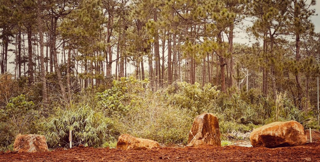
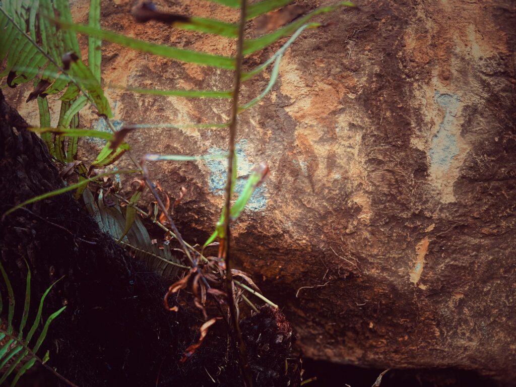
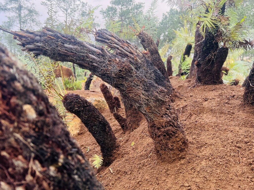
Những vệt cắt của địa tầng cảnh quan tạo cho vùng đất một tính cách riêng biệt mang âm hưởng bản địa.
Những khối đá ủ mình trong đất được ôm ấp và tâm tình với bóng đêm và làm bạn với những quân đoàn mối và côn trùng.
Những gốc dương xỉ cổ đại sần sùi, gân guốc chạm mặt ngã nghiêng hứng giọt nắng của trời để ngập ngụa trong màu xanh mơn mởn của tàng lá.
Cả ba dạng hình thái của sự sống cùng hội tụ để tạo nên ý niệm cảnh quan bản địa nơi vùng đất đầy gió và mây này.
Kiến trúc sư Hồ Viết Vinh.06122025
Next project | Self-portrait
Self portrait
Vinhho
Acrylic on canvas
80x120cm
Maison d’Art
2025
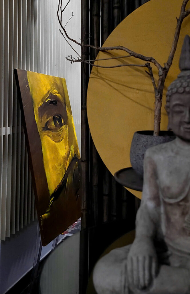
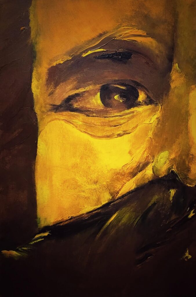
Next project | Shadowy
Vinhho, Acrylic on canvas, 130x97cm, Maison de Corail, 2024
“The interplay of dark and light hues conjures a spectral dance of shadows, evoking the elusive nature of the intangible, whispers of the hidden dimensions that lie beneath the surface, suggesting an eternal struggle between presence and absence.”
Ho Viet Vinh
Next project | FRAGILITY
FRAGILITY
“A sea of swirling blue, evokes the tempestuous depths of the soul, adrift in a world of fleeting beauty and despair. The stark white, a beacon of hope, struggles against the relentless tide of azure, a poignant reminder of the fragility of human existence.”
Ho Viet Vinh
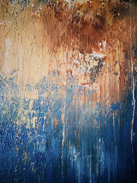
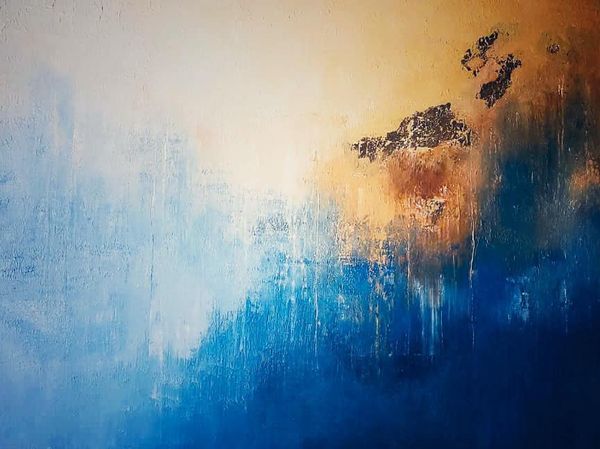
Acrylic on canvas, 130x97cm, Maison d’Art, 2024
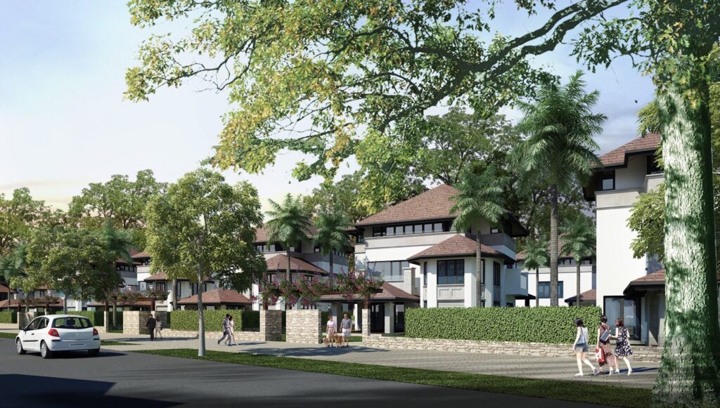
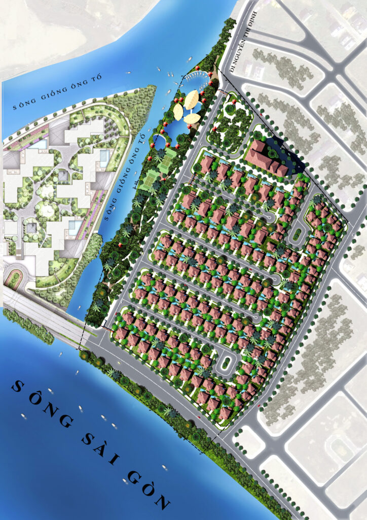
Next project | Marina Saigon Villa
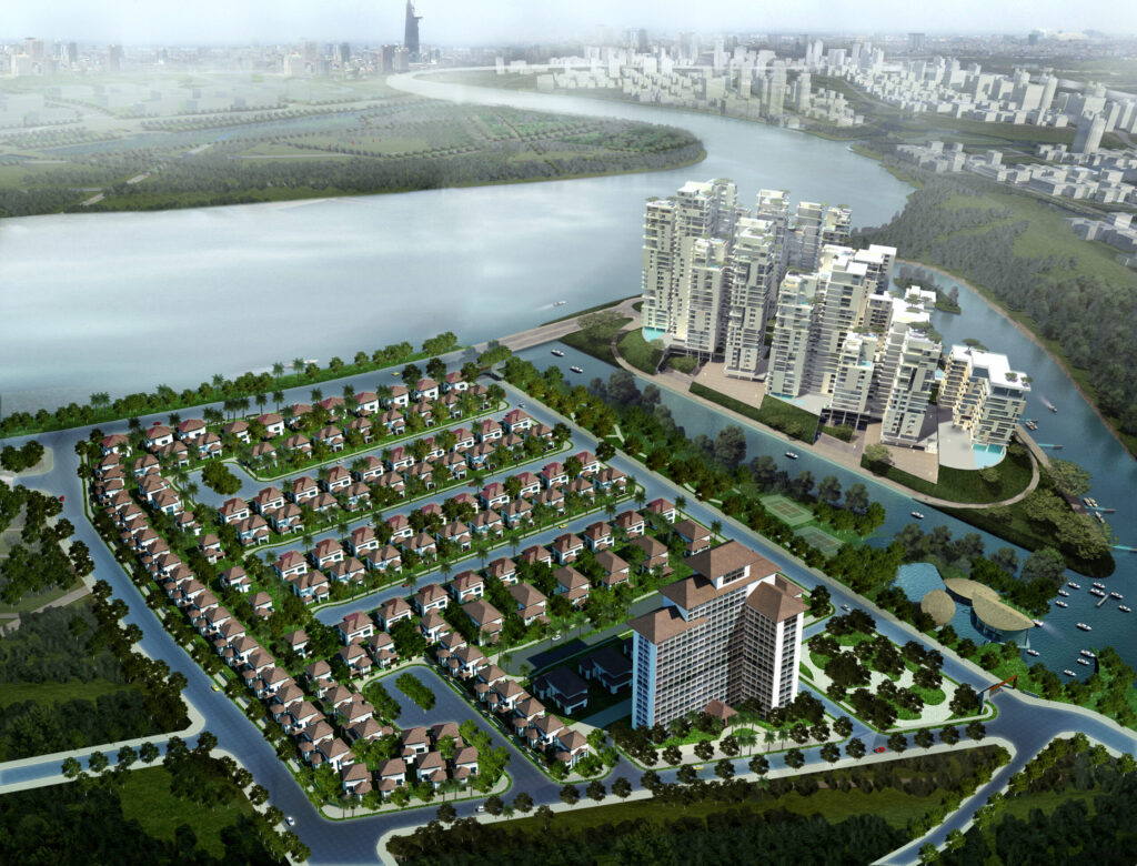
The marina lifestyle has its own allure, and life at Marina Saigon Villa elevates it to a unique experience, allowing you to savor life your way. Even if you’ve never owned a yacht before, you’ll seamlessly join the circle of enthusiasts reminiscent of 19th-century European aristocrats.
From the marina, where every villa boasts its own sparkling turquoise sails, you can personally navigate your yacht to capture moments of emotional conquest and freedom.
Each time you step aboard, you’ll realize that time ceases to be an obstacle. Whether heading to the trading center or the stock exchange in the heart of Saigon Trade Center, the journey is effortless.
In just a few minutes, you’ll arrive at your favorite golf course. Within 30 minutes, you can sail across the Saigon River to breathe the fresh air of Can Gio, a UNESCO Biosphere Reserve, or head upstream to explore the historic Cu Chi tunnels—or venture anywhere your heart desires.
Experience the unparalleled beauty of the vast riverscape and open skies, where every journey is an adventure waiting to unfold.
Type
Residential
Year
2015
Area
20 hectares
Location
District 2, Ho Chi Minh City
Team
Ho Viet Vinh
Tran Thanh Hai
Nguyen Dinh Nhat Thu
Truong Anh Thu
Next project | White lotus
An elegant white tone as the main theme, featuring multi-layered spaces with depth and subtle connections. The space is shaped with soft curves inspired by abstract nature creating a sense of fluidity and natural flow in the architecture. The decorative surfaces of loose furniture are finished with high-quality Vietnamese lacquer techniques. Natural light blends harmoniously with artificial lighting, interacting with materials like glass, lacquer, premium fabrics, and marble, evoking emotional contrasts between light, material, and space. The overall design exudes a contemporary artistic elegence.
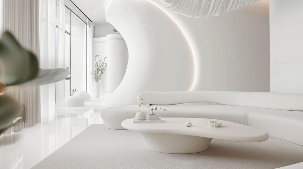
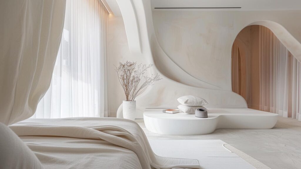
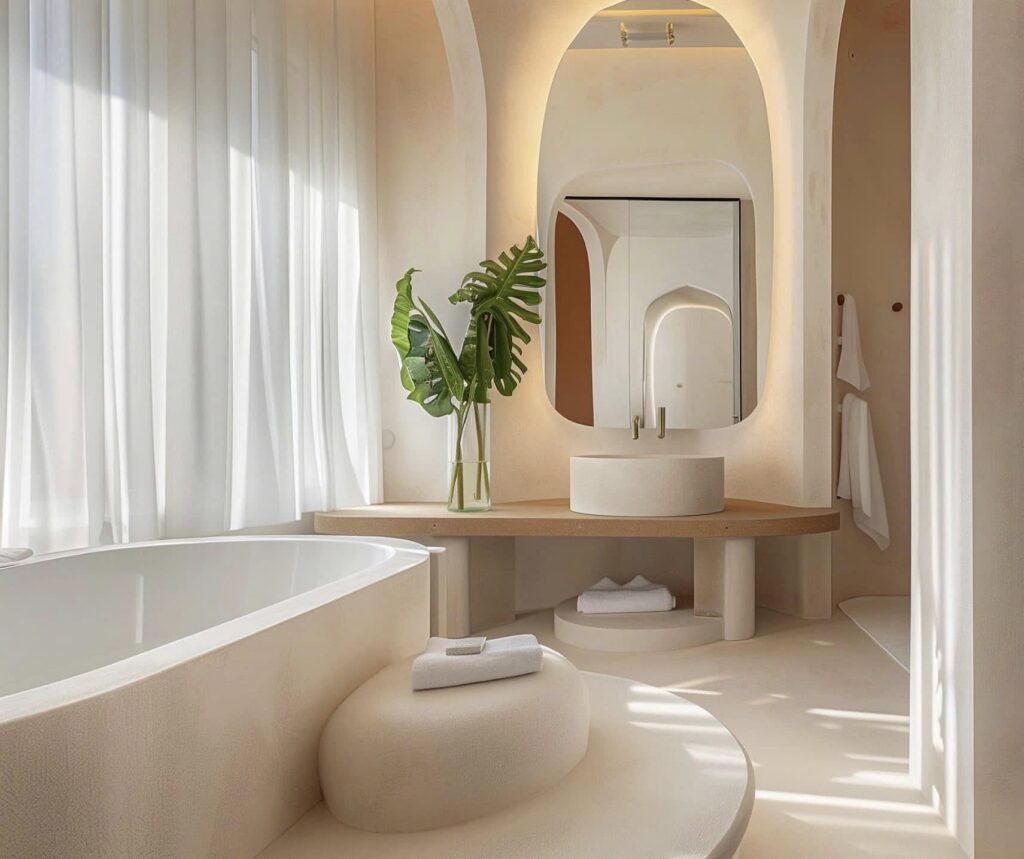
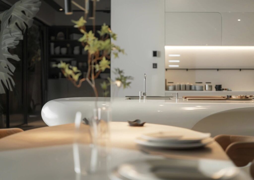
HVV Architect & Partners with AI supported
Next project | Nostalgia
“The gentle interplay of light and shadow dances across the room, reminiscent of a fading memory. Each element, from the plush seating to the artful arrangement of books, whispers stories of bygone days. The warmth of wood and fabric envelops the senses, creating a cocoon of comfort and reflection. This harmonious blend of textures and hues captures the essence of nostalgia, a poetic journey through time, where beauty and melancholy coexist in a delicate balance.”

Next project | Architecture and Fine Arts during the reign of Khai Dinh, a historical perspective
Architecture of each nation evolves and develops along a historical trajectory. Particularly, royal architecture establishes solid foundations refined over time, becoming the formal language through which art thrives. Each dynasty selects its own stylistic language as a benchmark for evaluation and a marker of its era.
The selective inheritance across dynasties shapes the orthodox architectural tradition. This tradition adheres to strict principles of form-making, setting standards that serve as measures of artistic creativity. However, the end of each dynasty invariably signifies adaptations to external influences. Ultimately, the flow of architecture is once again reshaped and renewed, continuing its progression.
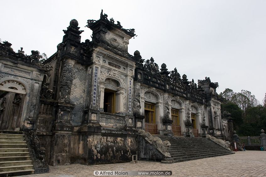
Emperor Khai Dinh utilized to infuse a sense of national identity into the architectural and artistic works of the royal court. These projects, executed during the late Nguyen dynasty, reflect a deliberate effort to adapt proactively to the changing circumstances.
Nearly a century later, the art of ceramic mosaic from the Khai Dinh era continues to flourish in temples, pagodas, shrines, and tombs.
To read the full research article below.
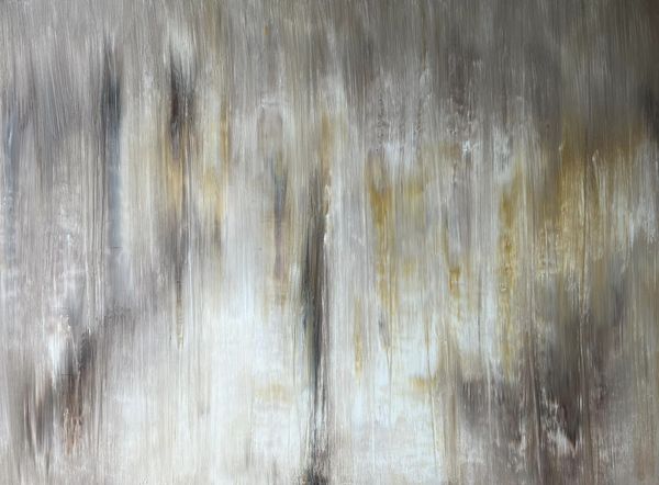
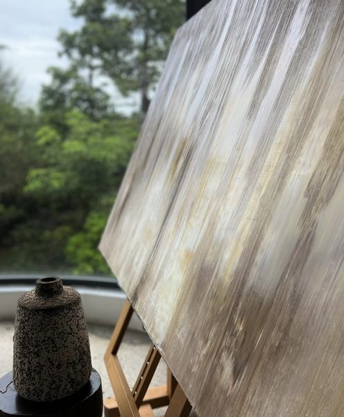
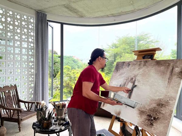
Next project | DRIFTING
“A delicate symphony of muted hues pirouettes in the ever-changing light. Its dance mirroring the soul’s ebb and flow, serving as a melancholic ode to time’s fleeting passage and life’s ephemeral beauty: a poignant reflection of existential drift.”
Ho Viet Vinh


Acrylic on canvas, 130x97cm, Maison d’Art, 2024