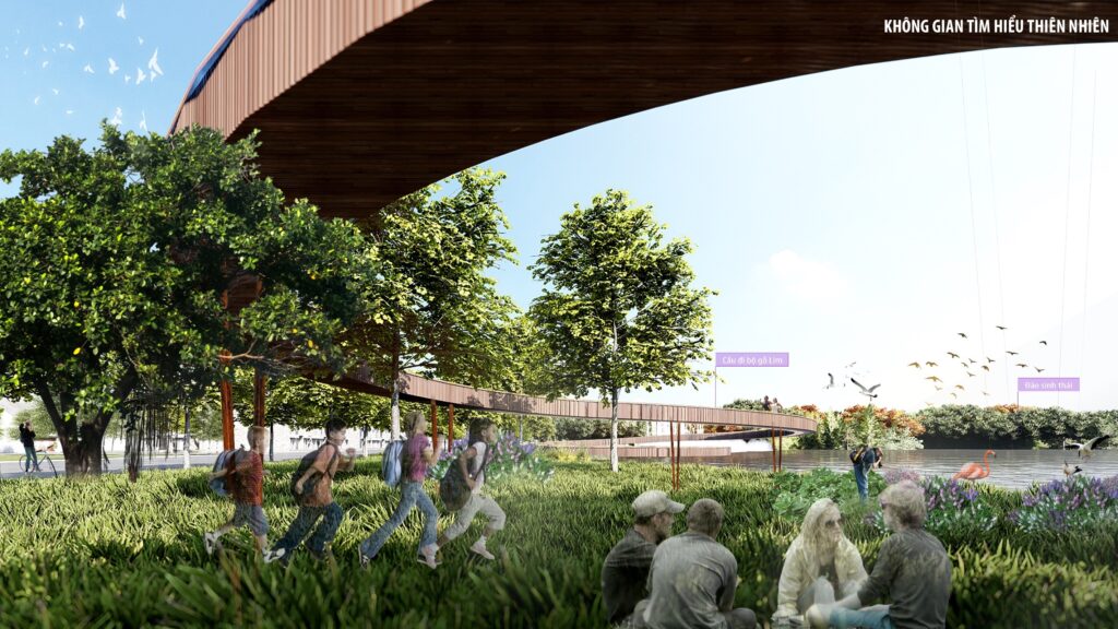
Lake Community Park is situated at the heart of the Huong Thuy new urban area, approximately 13.5 km southeast of Hue city center. The Park is conveniently located near Phu Bai Airport and the North-South railway line, just 3.5 km from Huong Thuy station, offering easy access for tourists traveling to and from the area.
Lake Community Park is built upon five core values:
- Green Lung: The park features over 23% water surface area and over 16% natural coverage.
- Central Location: Strategically positioned to connect neighboring areas and Hue city center.
- Transport Hubs (TOD): Integrated with national highways, railways, and aviation systems.
- Balanced Spaces: Harmonizing ecological, agricultural, and eco-residential areas.
- Enhanced Land Use Value: Diversifying functions based on ecological footprints to maximize value.
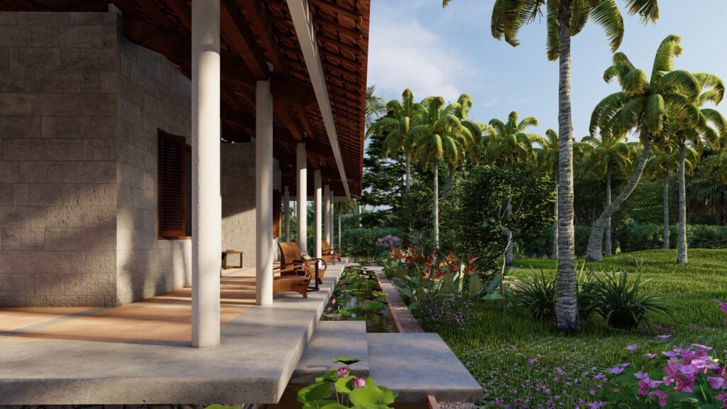
Next project | RETREAT HOME, Ben Tre city, Vietnam

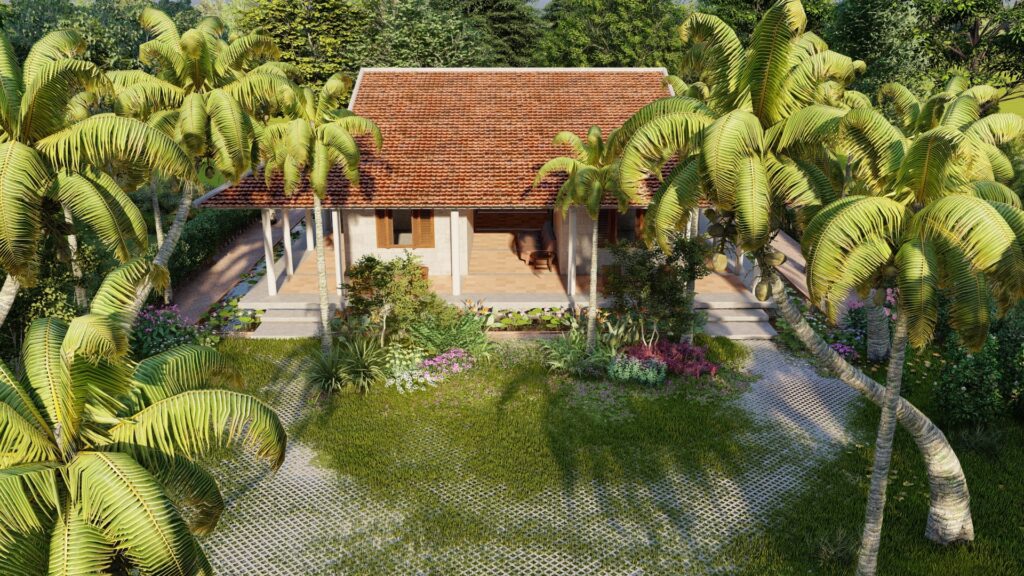
Nestled quietly under the canopy of the coconut forest swaying in the gentle breeze, the simple house comes into existence thanks to the reflections of the dawn sunlight. The house has a simple modern look, inheriting the shape of a traditional house with 3 compartments and 2 wings, with a large veranda surrounding it. The veranda is a transitional space and acts as a climate regulator for the whole house. Not only that, but it is also a place where countless activities connect people with the surrounding open space. The rooms all open to the garden and the doorways pull the garden into its deepest recesses. The nuanced transitions of time and space also take place in the cut of this patio.
Next project | Melaleuca Forest
Melaleuca forest
The sky turned gray-gray, the melaleuca forest changed color under the lopsided sunlight penetrating through the canopy of leaves, the ground tilted and swayed with the withering colors of countless flowers and leaves. The sparkling black velvet water reflects the identity of the forest of the elders: the splendid harmony of the late afternoon.
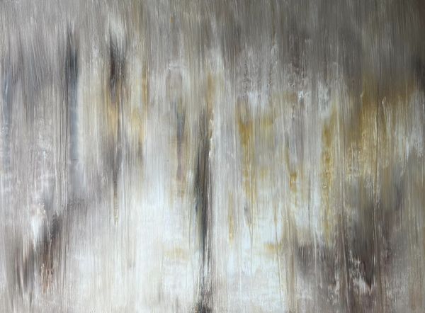
Description
Exucuted in April 2020
Styles
Lyrical Abstract
Technique
Acrylic on Canvas
Dimension
100W x 100H x 5D cm
The authenticity of this work has been confirmed by the HVV Architect &Partners. A certificate of authenticity maybe delivered by the Company upon request to the buyer.
Vinhho Biography
Ho Viet Vinh is a Vietnamese architect who graduated with a Bachelor of Architecture degree in 1995 from the University of Architecture Ho Chi Minh City, Vietnam, where he received an award for creative design in his final year. He is a Registered Architect in Vietnam, a Registered Urban Planner in Ho Chi Minh City, and a member of the Association of Architects and Urban Planners of Vietnam.
Vinh’s career began in 1995 with participation in several design competitions in Ho Chi Minh City. That same year, he became a lecturer in the Urban Planning Department at the University of Architecture.
In 1998, he won second prize in the international competition organized by the Summer Workshop of Cergy-Pontoise, France, with the theme “Ho Chi Minh City and the Saigon River.”
In 2005, he was awarded a special prize in another international competition by the Summer Workshop of Cergy-Pontoise, France, for his project “Can Gio Emotional City.”
In 2010, he participated in the U.S. International Visitor Leadership Program (IVLP) focusing on Sustainable Urban Planning.
In 2015, Vinh was selected by the Lebadang Creative Foundation to design the Lebadang Memory Space Museum in Hue. During this time, he also became the Director of the Fund.
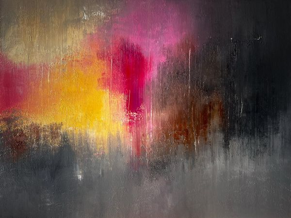
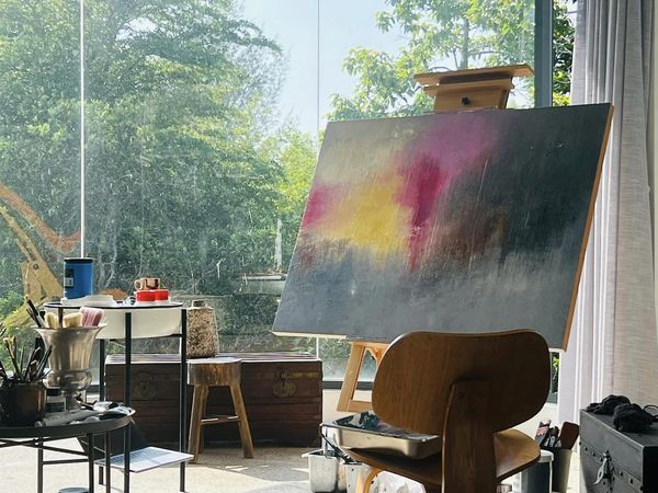
Next project | GLINT
GLINT
The interplay of these hues, it conjures images of a visual symphony, each segment of the painting whispering a different melancholic melody or vibrant cheer. This piece truly captures the ineffable ‘glint’ of emotions.
Ho Viet Vinh

Acrylic on canvas, 97x130cm, Maison d’Art, 2024
Next project | Tự tại
Êm đềm tựa giọt sương tinh khiết gieo mầm an lành.
Can trường cắm cội rễ sâu bền trước bão lũ.
Hoa trôi nở hương thơm giữa dòng nổi sóng, bờ cỏ lặng lẽ tựa mặt hồ thu.
Hương Giang trở thành ngọn đuốc chánh niệm – vừa tỏa sáng tự thân, vừa soi đường dẫn lối.
Next project | Kiến trúc và phẩm giá
Kiến trúc sư Hồ Viết Vinh (Đêm giao thừa đón Xuân Ất Tỵ 2025 tại Cố đô Huế)
Trong bối cảnh hiện nay khi thế giới đang đối mặt với những thách thức lớn về môi trường, biến đổi khí hậu và sự phát triển bền vững, giá trị phổ quát của kiến trúc chính là nâng cao phẩm giá của con người trong mối tương quan với thiên nhiên. Phẩm giá này được tạo dựng dựa trên các nền tảng sau:
- Kiến trúc là cầu nối giữa con người và thiên nhiên: Kiến trúc không chỉ là việc tạo ra những công trình để che chở con người mà còn là cách để con người kết nối với thiên nhiên một cách hài hòa. Thiết kế kiến trúc tốt phải tôn trọng và phản ánh mối quan hệ tự nhiên giữa con người và môi trường, thay vì tách biệt hoặc đối đầu với thiên nhiên.
- Nâng cao phẩm giá con người: Kiến trúc có khả năng nâng cao chất lượng cuộc sống và phẩm giá con người thông qua việc tạo ra những không gian đẹp, tiện nghi và ý nghĩa. Một công trình kiến trúc tốt không chỉ đáp ứng nhu cầu vật chất mà còn nuôi dưỡng tinh thần, cảm xúc và nhận thức của con người.
- Thiên nhiên là nguồn cảm hứng vô tận: Thiên nhiên không chỉ là yếu tố cần được bảo vệ mà còn là nguồn cảm hứng vô tận cho kiến trúc. Các nguyên tắc tự nhiên như sự cân bằng, đa dạng và thích ứng có thể được áp dụng vào thiết kế. Kiến trúc tương lai cần học hỏi từ thiên nhiên để tạo ra các giải pháp bền vững và hiệu quả.
- Kiến trúc bền vững là trách nhiệm đạo đức: Trong bối cảnh biến đổi khí hậu và suy thoái môi trường, kiến trúc có trách nhiệm đạo đức trong việc bảo vệ thiên nhiên và giảm thiểu tác động tiêu cực. Kiến trúc bền vững không chỉ là xu hướng mà còn là sự cần thiết để đảm bảo tương lai cho các thế hệ sau.
- Kiến trúc tương lai chính là tạo dựng sự hài hòa giữa con người, thiên nhiên và công nghệ: Kiến trúc tương lai cần kết hợp hài hòa giữa nhu cầu của con người, sự tôn trọng thiên nhiên và ứng dụng công nghệ tiên tiến. Công nghệ không nên là yếu tố thống trị mà là công cụ để hỗ trợ con người sống hòa hợp với thiên nhiên.
Kiến trúc tương lai cần đặt con người và thiên nhiên vào trung tâm, từ đó tạo ra những không gian không chỉ đẹp và tiện nghi mà còn bền vững, nhân văn và giàu ý nghĩa. Đây không chỉ là mục tiêu của kiến trúc mà còn là trách nhiệm của toàn xã hội trong việc xây dựng một tương lai tốt đẹp hơn.
Next project | Cloud stream
Vinhho, Arcylic on canvas, Dallat 2020
Solid and rough are the emotions of Da Lat. Spatial topography consists of interlaced hills, layers hidden under layers of cold pine forests. In that autumn silence, the clouds are the witch who transforms to soften the rough, dry and cold.
CLOUD STREAM
Following the wind, the stream flows in all directions,
The foggy road is dotted with flying dew drops.
Love is drunk at night in dreams,
Filled with the call of the human realm.
SUỐI MÂY
ho viet vinh. dallat 2019
Theo làn gió suối tuôn về muôn nẻo,
Đường mù sương lấm tấm hạt sương bay.
Tình men say gối đêm vào giấc mộng,
Cho ngập lời tiếng gọi cõi nhân sinh.
Next project | Shadowy
Vinhho, Acrylic on canvas, 130x97cm, Maison de Corail, 2024
“The interplay of dark and light hues conjures a spectral dance of shadows, evoking the elusive nature of the intangible, whispers of the hidden dimensions that lie beneath the surface, suggesting an eternal struggle between presence and absence.”
Ho Viet Vinh
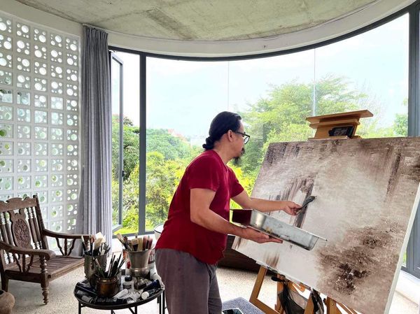
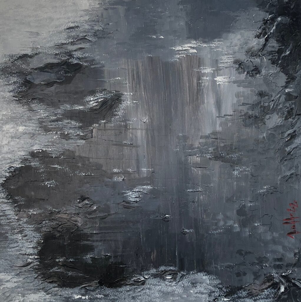
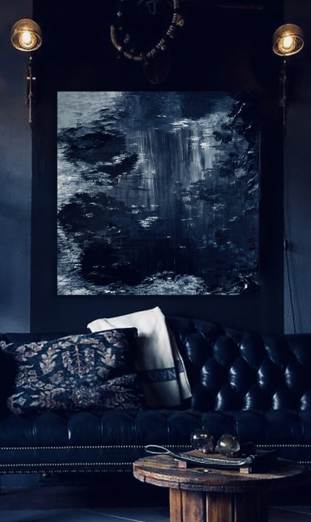
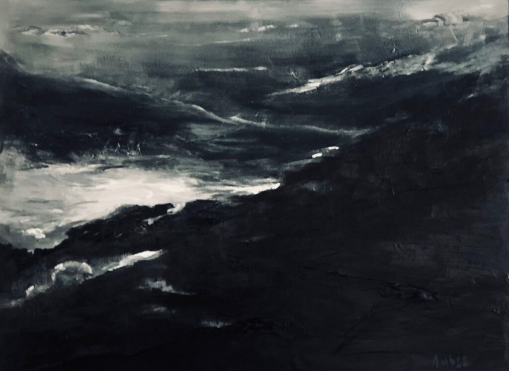
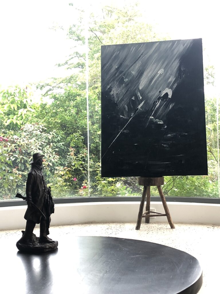
Next project | Forest rain
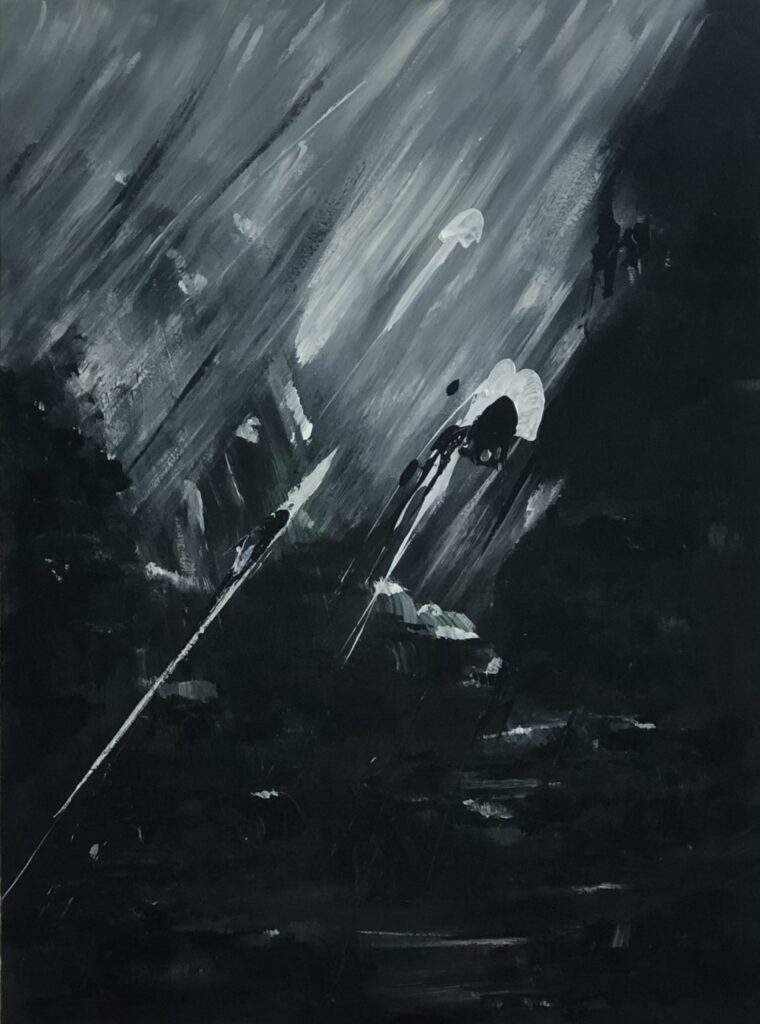
Forest rain.
Streams of water weave across the sky like a loom, tracing delicate horizontal lines. Thick fog veils the forest in the dark of night.
Ho Viet Vinh 2020
Vertical and horizontal water jets carve an intricate painting into the air.
Description
Exucuted in April 2020
Style
Lyrical Abstract
Technique
Acrylic on Canvas
Dimension
97W x 130H x 4D cm
The authenticity of this work has been confirmed by HVV Architect &Partners. A certificate of authenticity maybe delivered by the Company upon request to the buyer.
Vinhho Biography
Ho Viet Vinh is a Vietnamese architect who graduated with a Bachelor of Architecture degree in 1995 from the University of Architecture Ho Chi Minh City, Vietnam, where he received an award for creative design in his final year. He is a Registered Architect in Vietnam, a Registered Urban Planner in Ho Chi Minh City, and a member of the Association of Architects and Urban Planners of Vietnam.
Vinh’s career began in 1995 with participation in several design competitions in Ho Chi Minh City. That same year, he became a lecturer in the Urban Planning Department at the University of Architecture.
In 1998, he won second prize in the international competition organized by the Summer Workshop of Cergy-Pontoise, France, with the theme “Ho Chi Minh City and the Saigon River.”
In 2005, he was awarded a special prize in another international competition by the Summer Workshop of Cergy-Pontoise, France, for his project “Can Gio Emotional City.”
In 2010, he participated in the U.S. International Visitor Leadership Program (IVLP) focusing on Sustainable Urban Planning.
In 2015, Vinh was selected by the Lebadang Creative Foundation to design the Lebadang Memory Space Museum in Hue. During this time, he also became the Director of the Fund.
Next project | DANCE of LIGHT
The “Dance of light” stirring a feeling of motion and vitality. This interplay between brilliance and obscurity crafts an enigmatic allure, coaxing the observer to explore the depths of light.
Ho Viet Vinh
(Vinhho, Acrylic on canvas, 130x97cm, Maison de Corail.2024)
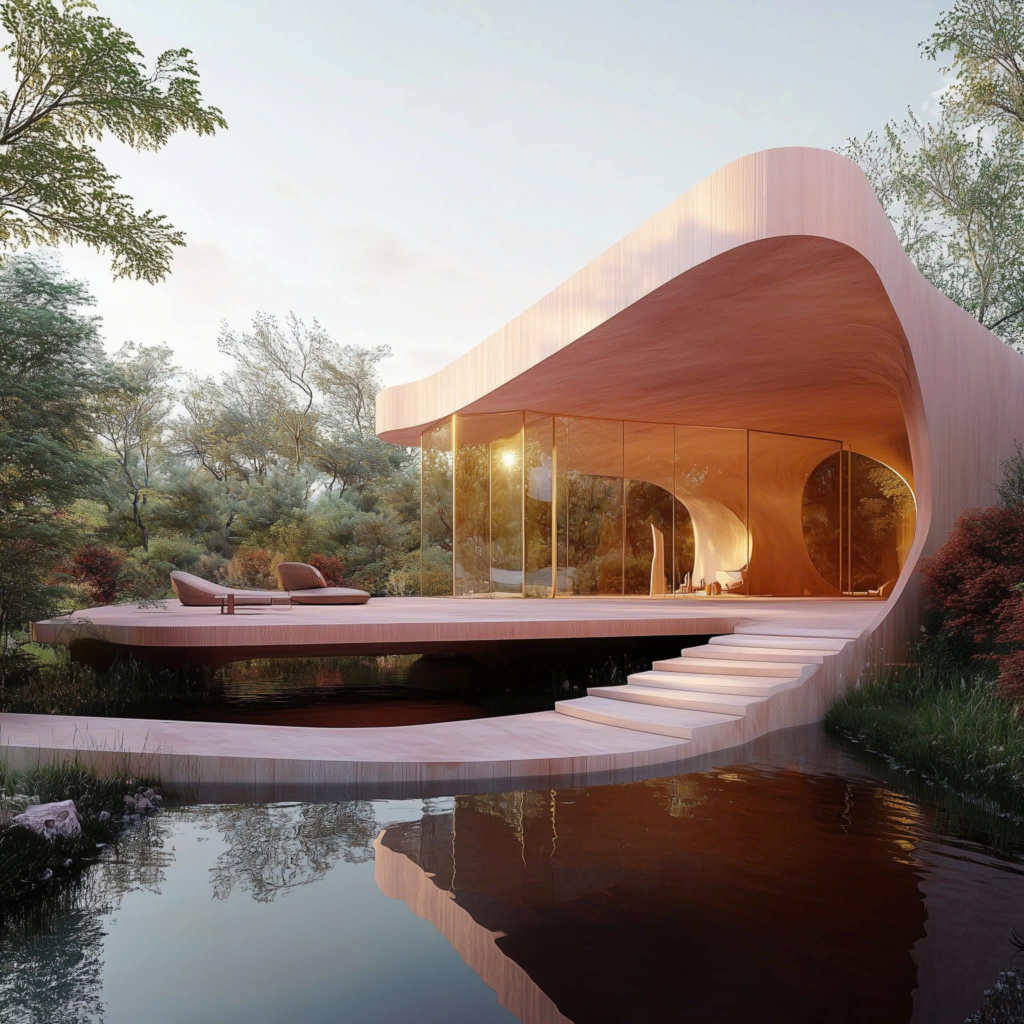
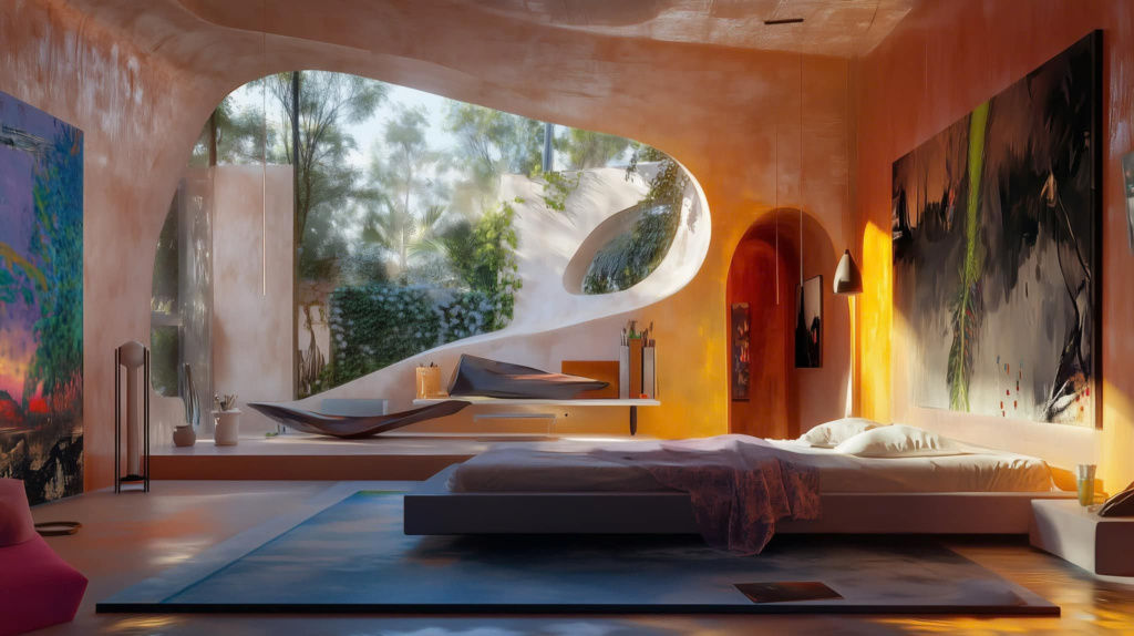
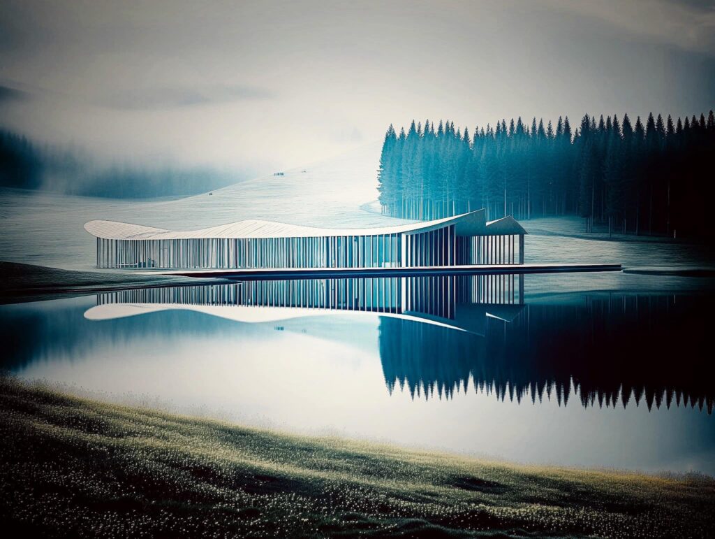
Next project | Maison de L’eau
Nestled gracefully above tranquil waters, Maison de l’Eau embodies the harmonious blend of modern architecture and nature. Its unique curved design, crafted from warm wood, invites sunlight to dance through expansive windows, offering breathtaking views of the surrounding forest. This serene retreat not only provides a peaceful sanctuary but also celebrates sustainable living, encouraging a deep connection with the environment. Maison de l’Eau stands as a testament to the beauty of simplicity, where every curve and corner reflects the gentle flow of nature, creating a perfect balance between comfort and elegance.