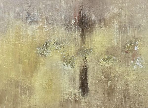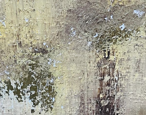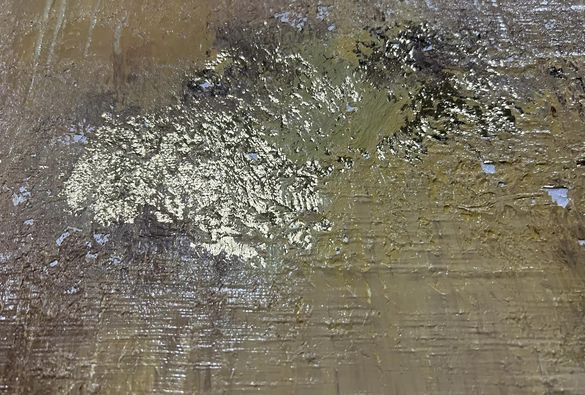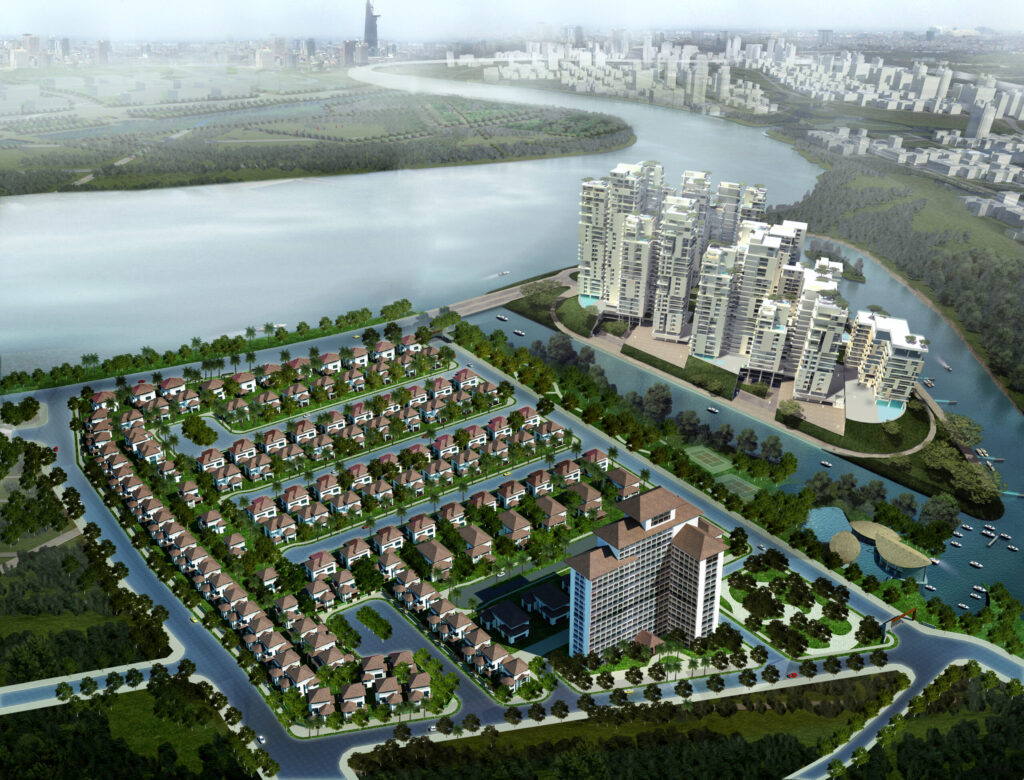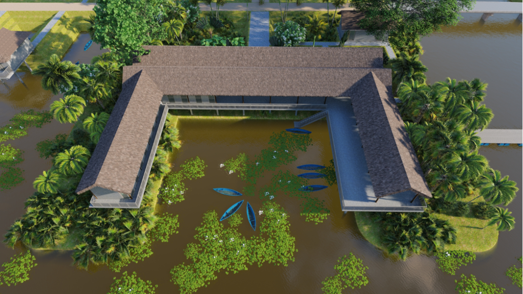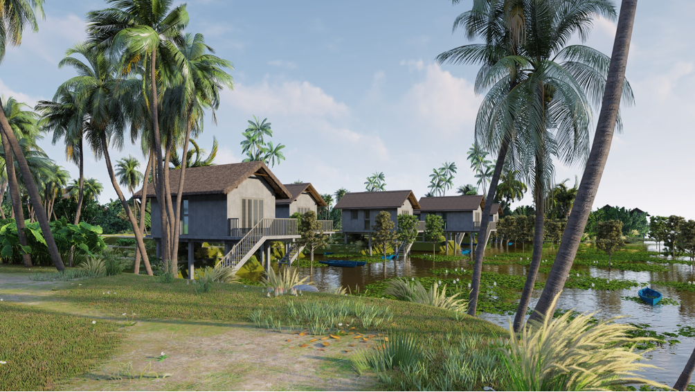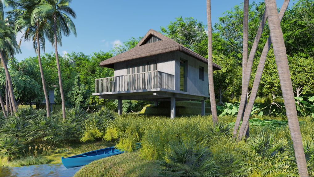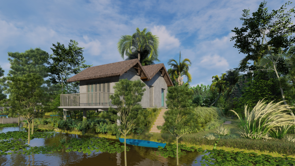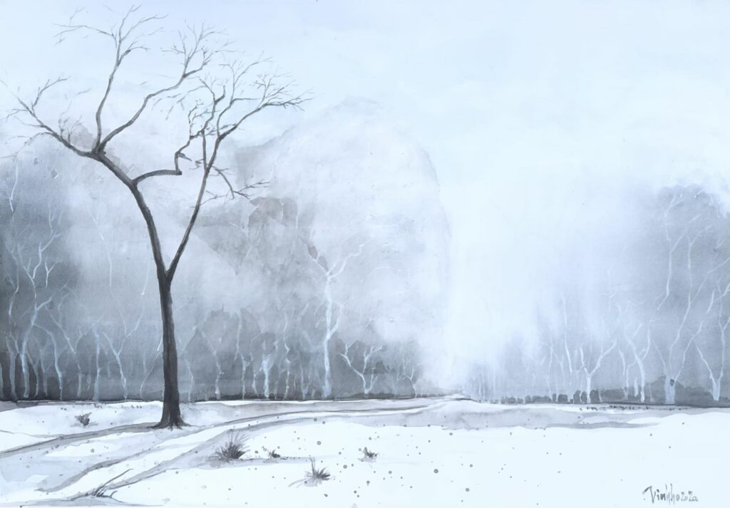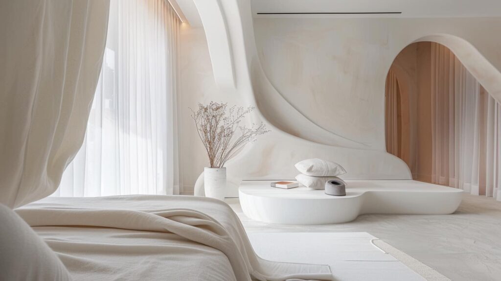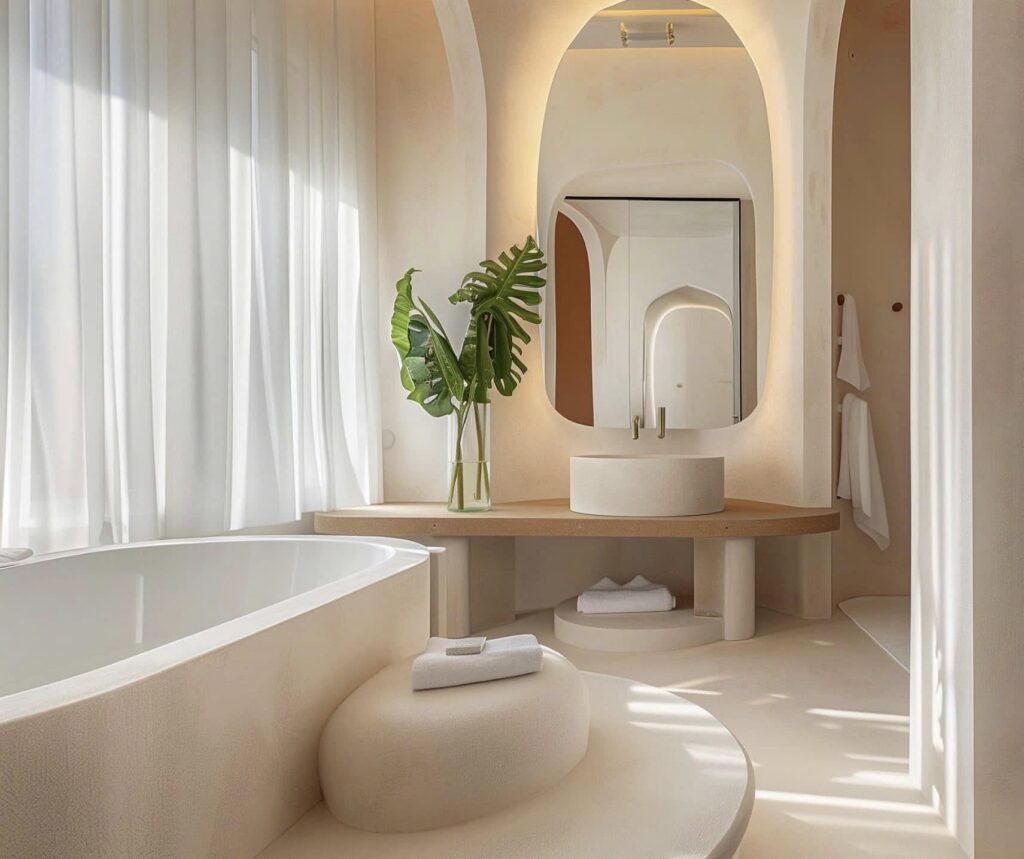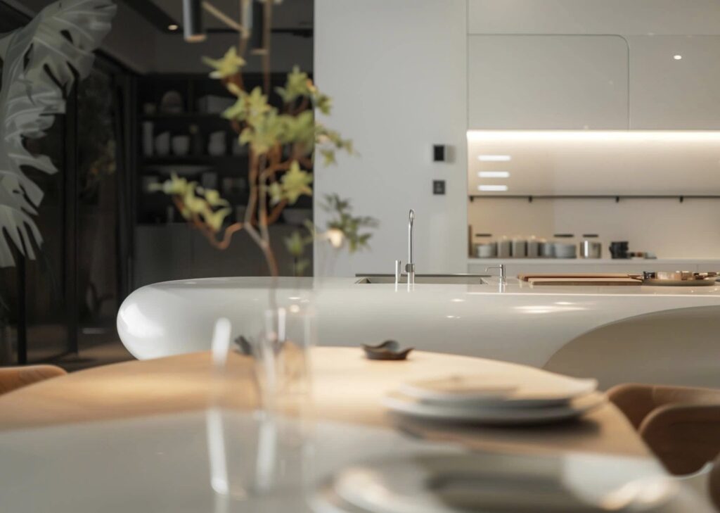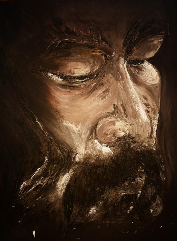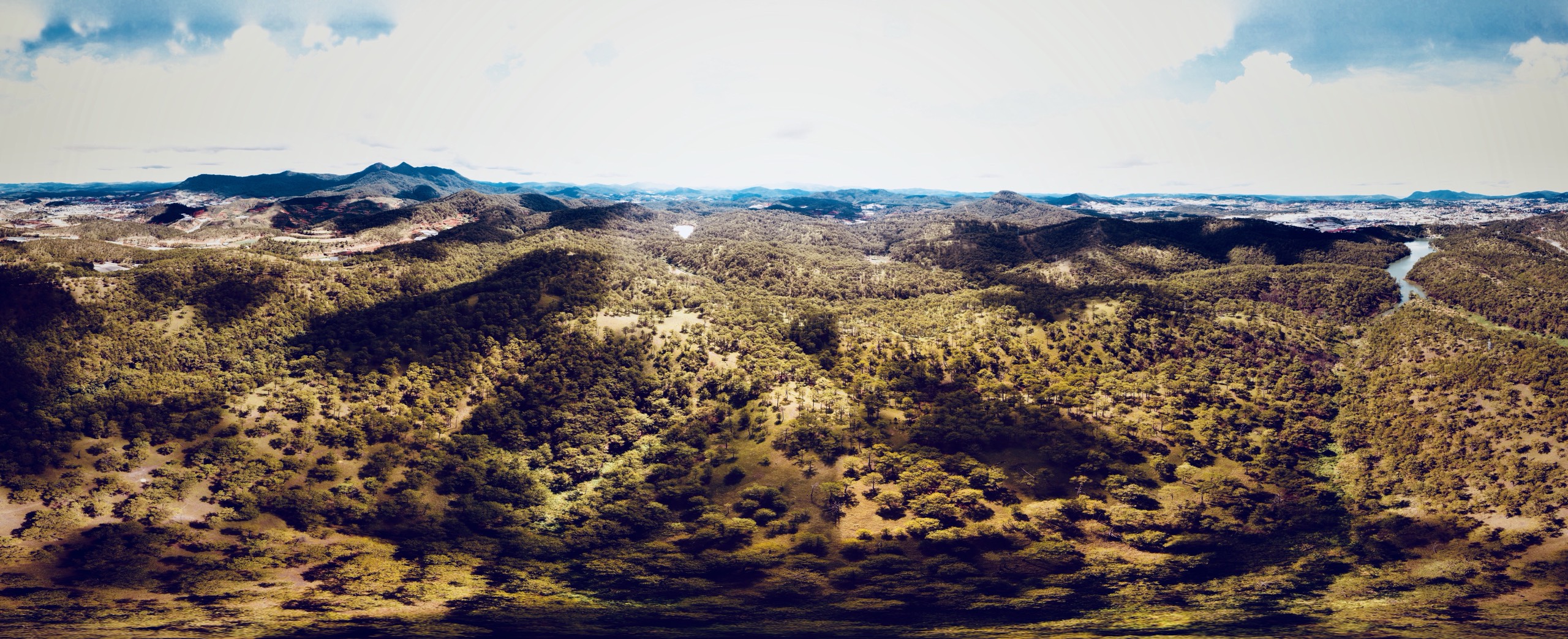
Bathing in the mist of the mountains and forests, we are like super crooked footsteps. Overconfidence has given way to humble trembling. Following the breath we look back at the decaying frame of the mythical years. I falter, bowing my head not to beg, but to apologize for the unruly bare-headed man.

Voices of nature

The melodious reverberation of the mountains and forests,
Clouds cover the rising sun,
I silently curled up in the wind,
Absorb the mist of the dawn light.

Âm vang núi rừng

Du dương vọng tiếng hoà ca rừng núi,
Mây ngập tràn che khuất mặt trời lên,
Ta lặng im cuộn mình trong làn gió,
Men hơi sương ngút ngọn ánh bình minh.

Ho Viet Vinh, Dalat 2021

Next project | Le Ba Dang Memory Space

The landscape architecture of the museum, spanning 16,000 square meters, is itself a full-scale “Lebadang Space” artwork. Paintings, sculptures, installations, and “Space” artworks by the world-renowned artist Lebadang are periodically rotated, with exhibition content and display methods meeting international standards.
The museum brings to life artist Lebadang’s dream of “an immense artwork, a cosmic landscape, a life in harmony with nature, and an eternal vision.” Its location in Hue, Vietnam’s ancient capital, embodies his aspiration for Hue to become the center of Vietnamese contemporary art and culture in the 21st century.

“Đường mòn lối nhỏ  lượn vòng quanh
Trăm hoa đua nở khoe hình sắc 
Thấp thoáng hương quê gió nội đồng
Toàn chân đón cảnh mây trời hiện
Một chốn tiên bồng giữa thế gian.”

“Small paths that revolve around
Hundreds of flowers in bloom
Village hidden behind rice fields
Flying clouds in the sky
What a great place. ”
Architect Ho Viet Vinh

A charcoal sketch by Vinhho on 2007

Le Ba Dang Memory Space reimagines the image of Co Loa as a unique creation of the Vietnamese spirit. Emotions are etched into the landscape like a giant painting. The winding pathways lead us into a vivid tapestry of reality, where people and nature merge as one. The soul finds peace, and emotions flow freely.
Brilliant flowers bloom, birds chirp joyously, the breeze carries drifting clouds, and every element resonates with authentic sounds, drawing our minds back to the dreams of childhood.

“Great architecture can give us hope, great architecture can heal.”

Type
Museum
Year
2019
Location
Huong Thuy, Hue
Team
Ho Viet Vinh, Tran Thanh Hai, Le Van Thoi, Ngo Dang Linh
Civil Engineer
Nam Viet
Contractor
Rickenbach Development and Construction
Interior Designer
Eric Mignagd
Lighting Designer
Elek Co, Ltd
Photographer
Dalo lab
Structural Engineer
Nam Viet

Press
ART REPUBLIK 1, Elitism for all, Spring-Summer 2020

Youtube
LeBaDang Memory Space – Contemporary Art in Hue – An article by Dalo Studio on Youtube via the link.

Next project | U Minh Thuong National Forest Ecological Experience Area
Project:
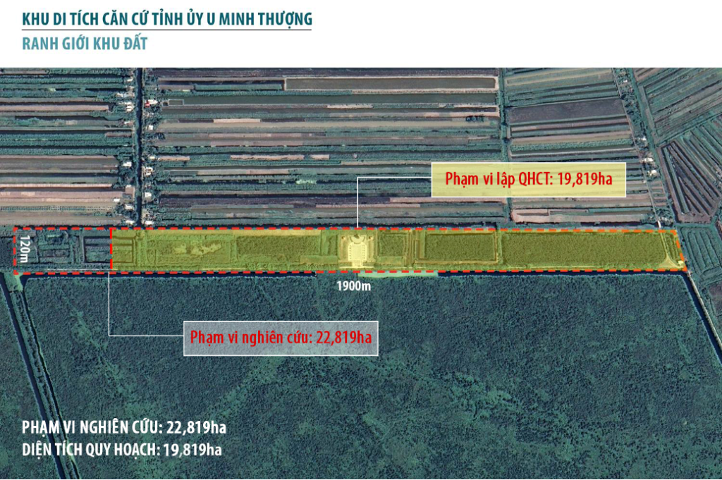
U Minh Thuong National Forest Ecological Experience Area
Location:
U Minh Thuong district, Kien Giang province
Area:
19,819 hectares
Services:
Urban planning, Architecture, Interior
Status:
Approved the detailed planning project at scale 1/500, 2019
Approved the project investment for the construction, 2020
Under construction
Team:
HVV architect and partners – CREA
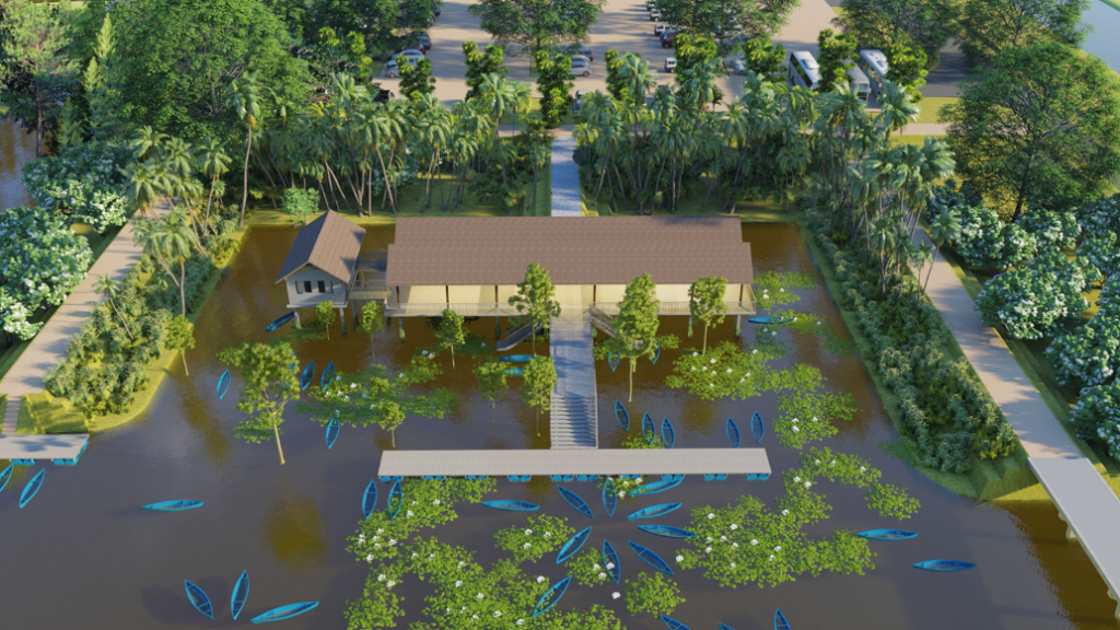
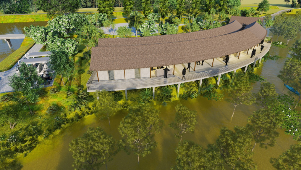
Aerialview

Characteristics
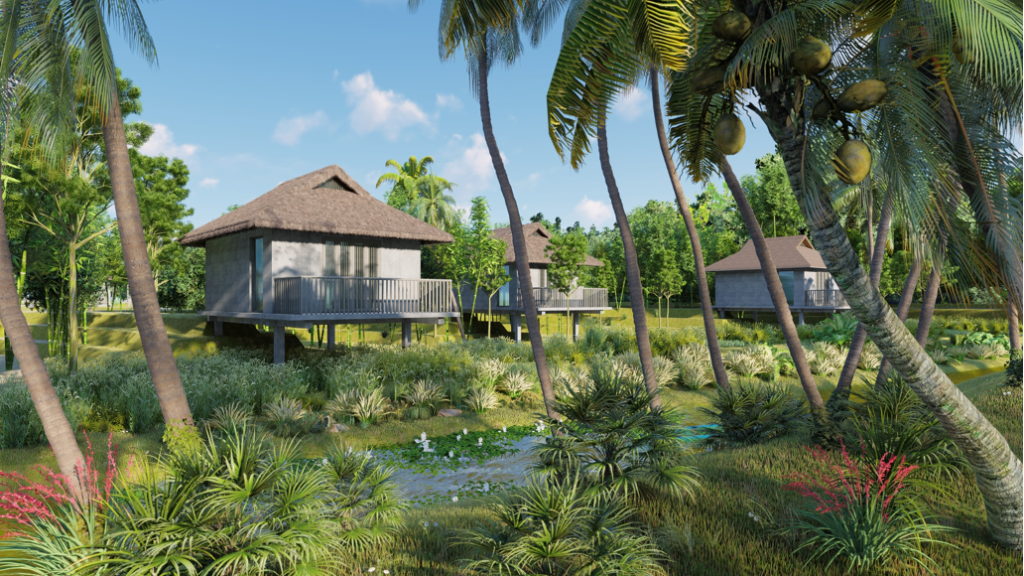
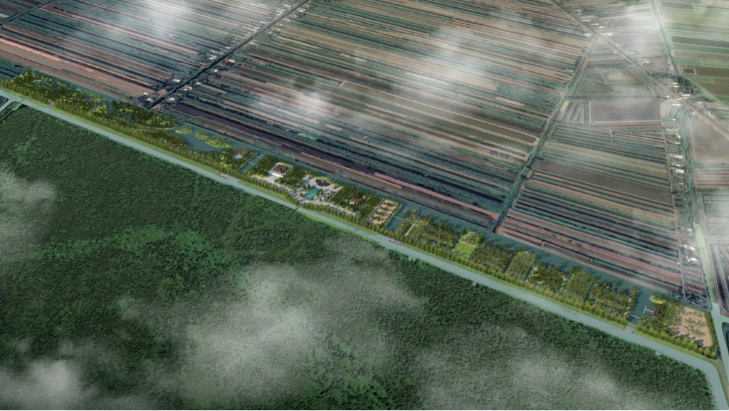
This is the former Provincial Party Committee Headquarter during the anti-American war, aimed at educating younger generations about revolutionary traditions and honoring the ecological and aesthetic values of U Minh Thuong National Forest in Kien Giang Province.

Design Principles

  1. Respect the existing landscape characteristics while creating diverse spatial arrangements to accommodate the various functions of the overall project.
  2. Inherit the cultural heritage values of Southern Vietnam through the development of a resort area that harmonizes local cultural elements with the natural landscape.
  3. Ensure vibrancy throughout the overall spatial design, maintaining solemnity in the central area while providing privacy and seclusion for functional areas such as eco-experience resorts, recreational areas, and spaces for outdoor activities reflecting Southern Vietnamese lifestyles.
  4. Protect the environmental landscape by preserving the existing ecological scenery, employing on-site earthworks, and utilizing local materials.
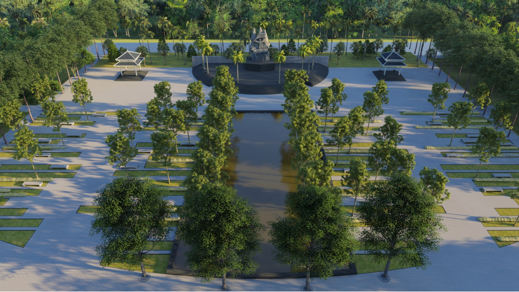
Square – monument
Traditional Provincial Party Committee Base
Service building
Restaurant
Lake Ecological Experience House
Garden Ecological Experience House
River Ecological Experience House
Melaleuca Forest Ecological Experience House
Club – Pier
Welcome Area – Southern Vietnamese Cuisine Restaurant
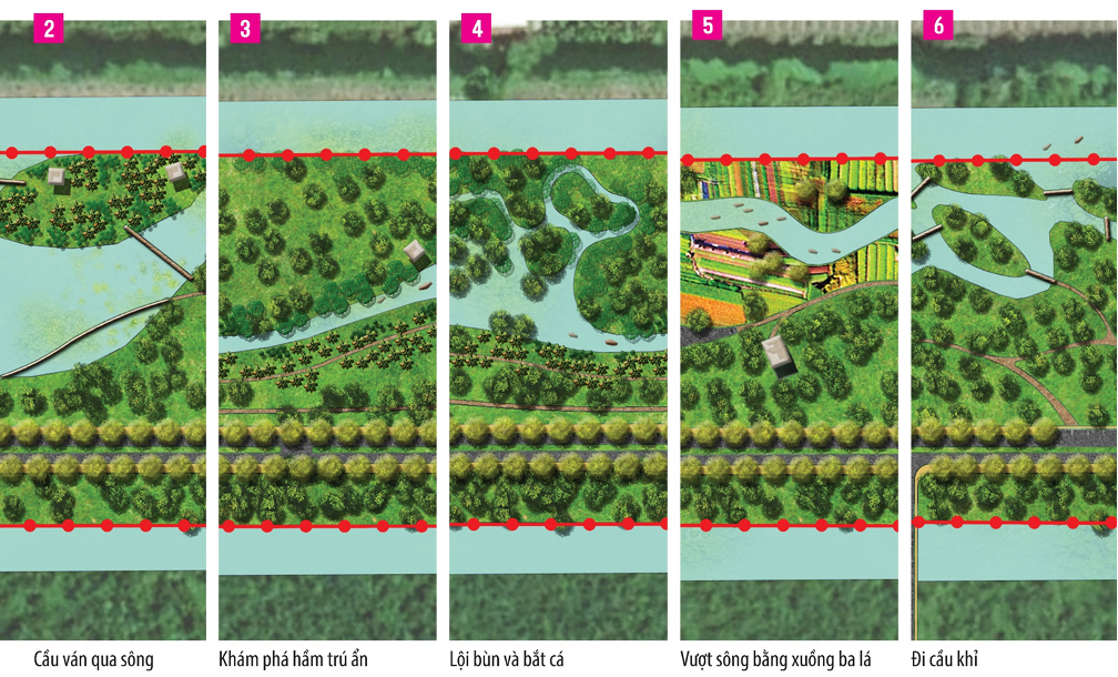
Diversity in Activities and Modes of Movement

Next project | Maison de L’eau

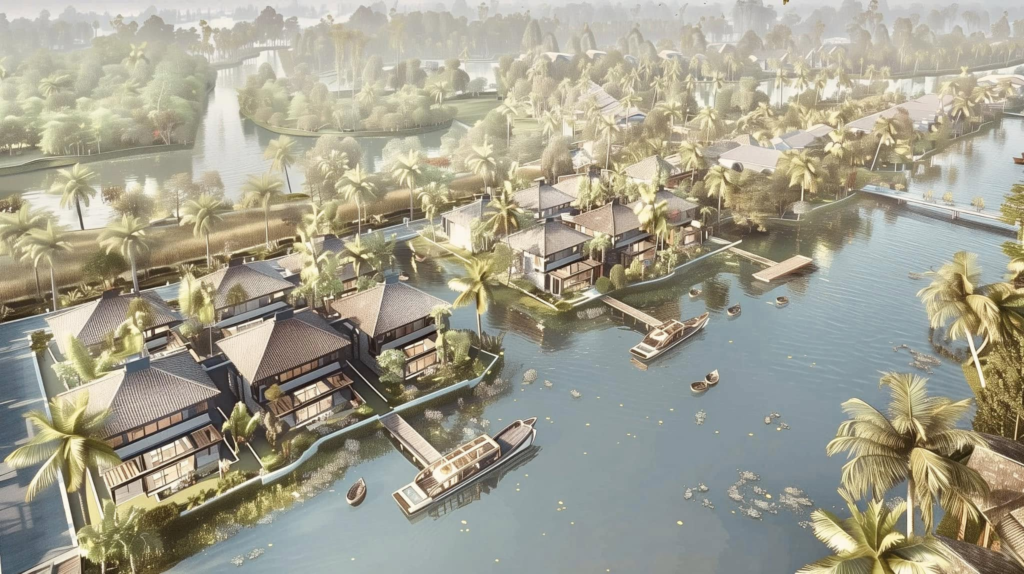
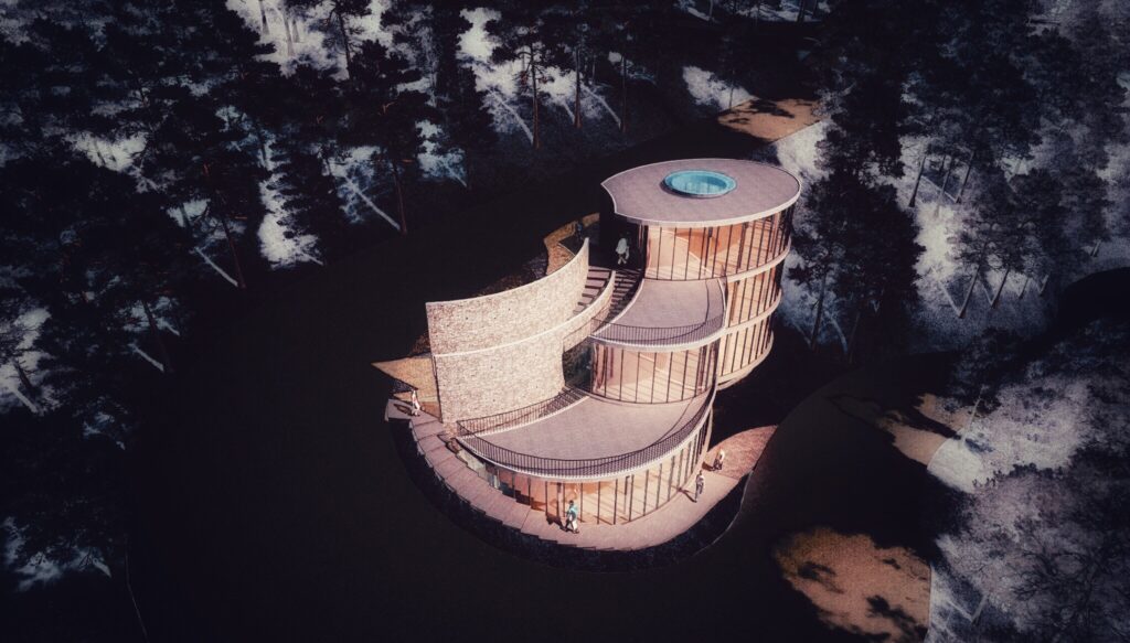
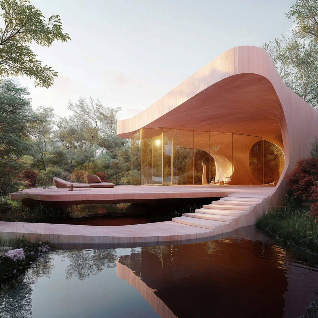
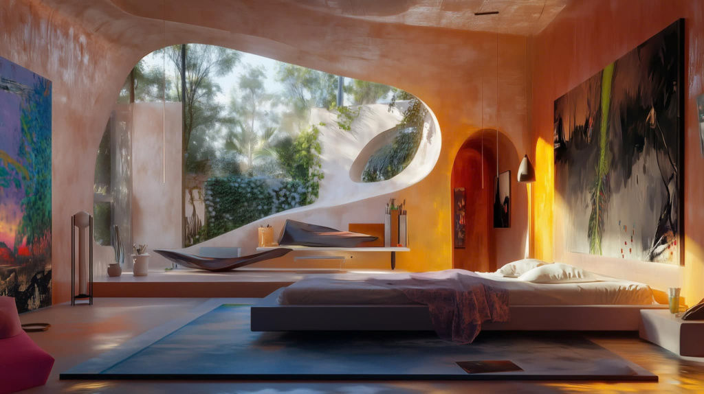
Nestled gracefully above tranquil waters, Maison de l’Eau embodies the harmonious blend of modern architecture and nature. Its unique curved design, crafted from warm wood, invites sunlight to dance through expansive windows, offering breathtaking views of the surrounding forest. This serene retreat not only provides a peaceful sanctuary but also celebrates sustainable living, encouraging a deep connection with the environment. Maison de l’Eau stands as a testament to the beauty of simplicity, where every curve and corner reflects the gentle flow of nature, creating a perfect balance between comfort and elegance.
HVV Architect & Partners supported by AI

Next project | RED KINGDOM – Masterplan of Brickyard village at Mang Thit, Mang Thit District, Vinh Long province

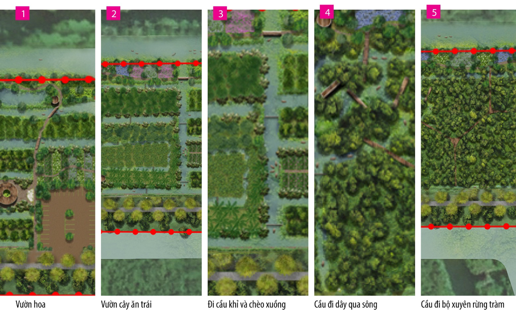
“This is a project to preserve and develop the Mang Thit traditional brick and masonry heritage area, combining production space and water landscape. This area is planned into a contemporary product with different functional layers: preserving ceramic tile craft villages, expanding living space along the river and recreating the unique river landscape of the South. The multi-level dike approach helps maintain riverside living space, supports ceramic production and also develops eco-tourism, turning the area into a cultural and experiential destination for visitors.”

HVV Architect & Partners

Client:
Board of Civil and Industrial Construction Project Management – Vinh Long province People’ s Committee
Location:
Mang Thit dictrist, Vinh Long province, Vietnam
Size:
3.060 hectares
Services:
Masterplan
Status:
Approved on 2024
Team:
HVV Architect & Partners –  Urban Planning Institute

Intro
Mang Thit District, Vinh Long Province, is one of the few remaining localities in Vietnam that preserves a unique and extensive architectural complex alongside a traditional craft. This architectural ensemble comprises nearly 1,000 domed kilns, spanning over 3,060 hectares along the banks of the Thay Cai, Hoa My, Cai Nhum canals, forming a southern arc that extends to the Nhon Phu and Hoa Tinh canals within the district. This is truly a valuable treasure, shaped by over a century of cultural and technological exchange between Khmer, Kinh, and Hoa people, resulting in a distinctive architectural heritage and traditional craft. However, this treasure has not been fully recognized or appreciated.
Over the past decade, more than 1,000 kilns have been demolished, and the remaining kilns are deteriorating and face the imminent threat of complete destruction. Given this alarming situation, it is imperative and urgent to conduct research and develop solutions to preserve and promote this architectural complex and traditional craft.

Learning from the Past and Looking to the Future

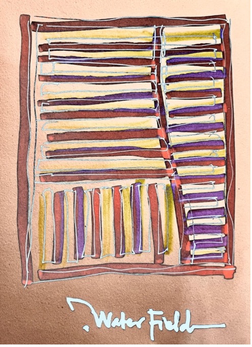
Over 100 years of formation and development, the structure of the craft village ecological system have established with 6 main space, including: surface water, brickyard system, yards, storage, fruite garden and house, fields.

The system of canals and land has formed a distinctive, easily recognizable landscape. Rivers and canals flowing from Co Chien River along Thay Cai canal, going deep into agricultural areas, have determined the main landscape axes; Residents live along the canals, inside are fruit and vegetable gardens, and deeper are fields and aquaculture areas. The ecosystem associated with the brick kiln area has created a closed process in the production of Mang Thit red ceramic. This is a characteristic and value that needs to be preserved and promoted.

Adaptive conservation in continued development

Adaptive conservation in continued development – preserving the existence of production space heritage, symbiotic ecological space, and Southern garden development cultural heritage; These valuable materials and spiritual values ​​have been perfected during the development process, providing a contemporary breath and improving the quality of each space, gradually improving the quality of life of local people, so that their politics will gradually transform, reviving the soul of the place.
The heritage of Mang Thit – known as The Red Kingdom will be an interesting destination in Mekong Delta and should not be missed in your lifetime.

Zonning plan

The area is divided into 9 main zones according to 3 layers.

No.1. Mixed-Use Development (Services – Tourism – Rural Residential): Approximately 347.91 hectares, with primary functions including residential development, mixed-use development (tourism services – rural residential), mixed-use development (services – urban residential), public services, public utility green spaces, specialized green spaces, other technical infrastructure, transportation, agricultural areas, and other functions.

No.2. Mixed-Use Development (Services – Urban Residential) along Co Chien River: Approximately 250.05 hectares, with primary functions including residential development, mixed-use development (services – urban residential), public services, public utility green spaces, specialized green spaces, heritage and religious sites, other technical infrastructure, transportation, agricultural areas, and other functions.

No.3.  My An – Hoa My Residential Area: Approximately 415.50 hectares, with primary functions including residential development, mixed-use development (services – urban residential), public services, public utility green spaces, specialized green spaces, heritage and religious sites, other technical infrastructure, transportation, agricultural areas, and other functions.

No.4. Cai Nhum Eco-Residential Area: Approximately 150.31 hectares, with primary functions including residential development, public services, public utility green spaces, other technical infrastructure, transportation, agricultural areas, and other functions.

No.5. My Phuoc Eco-Resort: Approximately 106.43 hectares, with primary functions including residential development, public services, public utility green spaces, tourism development, other technical infrastructure, transportation, agricultural areas, and other functions.

No.6.  My Phuoc Eco-Residential Area: Approximately 253.76 hectares, with primary functions including residential development, public services, public utility green spaces, specialized green spaces, heritage and religious sites, offices, other technical infrastructure, transportation, agricultural areas, and other functions.

No.7. Nhon Phu Eco-Residential Area: Approximately 309.78 hectares, with primary functions including residential development, public services, public utility green spaces, heritage and religious sites, offices, other technical infrastructure, transportation, agricultural areas, and other functions.

No.8. Hoa Tinh Eco-Resort: Approximately 198.23 hectares, with primary functions including residential development, mixed-use development (services – urban residential), public services, public utility green spaces, heritage and religious sites, offices, transportation, agricultural areas, and other functions.

No.9. High-Tech Agriculture Area: Approximately 1,028.03 hectares, with primary functions including residential development, public utility green spaces, tourism development, other technical infrastructure, transportation, agricultural areas, and other functions.

Master plan

The plan identifies 3 main development axes including:

  • Mang Thit brick and ceramic kiln space at the center combined with service corridor along Co Chien river, agricultural experience corridor – traditional garden village along Cai Nhum river, high-end resort tourism corridor in the South;
  • Mixed service axis – contemporary residential area in the Southern region of the West;
  • The Eastern resort tourism axis will create motivation for development of the entire region.

The resort spaces around heritage area (My Phuoc eco resort, My Phuoc Eco-Residential area, Nhon Phu Eco-Residential Area, Hoa Tinh Eco-Resort) offer a variety of ecological, cultural and agricultural production experiences, taking the ceramic brick kiln area as inspiration for creativity.

Oriented masterplan development diagram to 2045

With 5 gateways – 5 landscape architectural spaces typical of the Southern rivers and the ceramic brick kiln area, it will be an unforgettable, impressive identification point when visitors approach the ceramic brick kiln area by both Water transport and road transport.

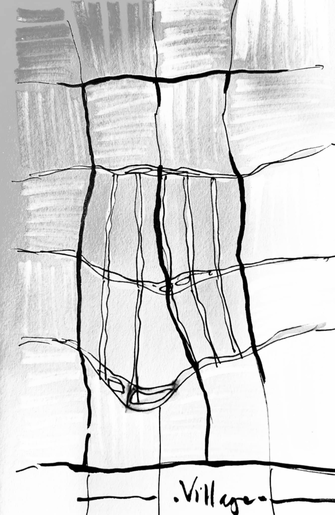
The landscape of the welcome gate, orchard and ceramic tiles combined with the riverside landscape follows a multi-level soft embankment model, providing many different experience spaces for visitors to explore the traditional Tile and Ceramic Craft Village along the Co Chien River.
The new residential community landscape is associated with the internal canal system. The riverside spaces are shaped by multi-level soft embankments creating different functions and landscape nuances according to the flooding season.
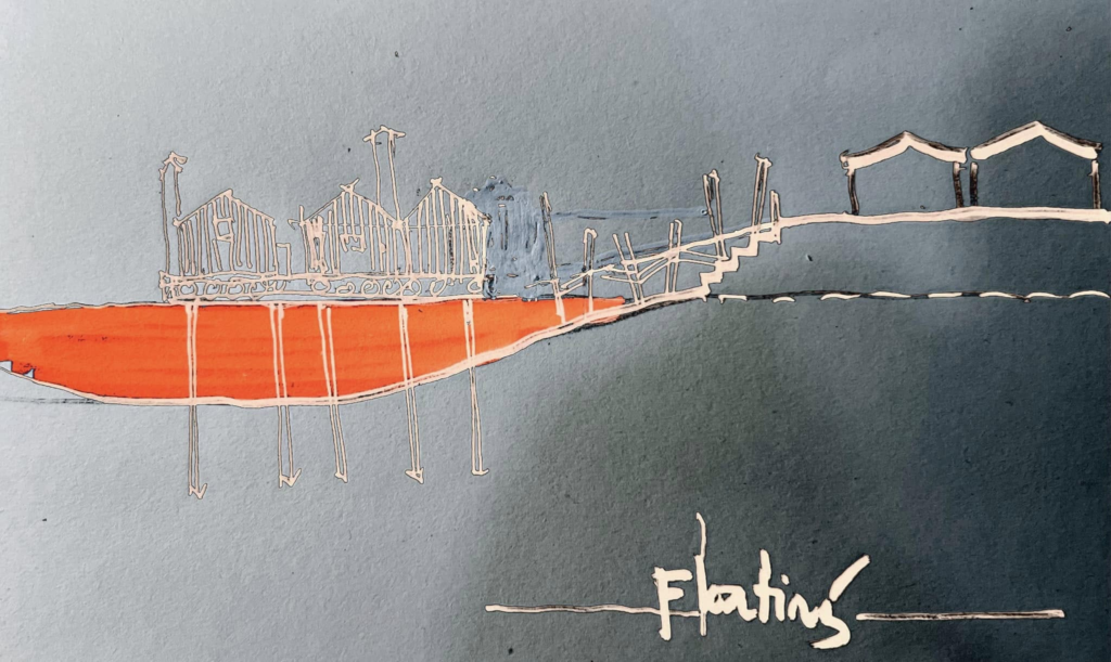
Landscape on both sides of Thay Cai canal, the core conservation area of ​​the ceramic craft village with a system of multi-storey soft embankments and alternating hard stepped embankments combined with a boat wharf and ceramic tile service space organized along the river. Support the transition process, while developing ecotourism, turning this area into a cultural and experiential destination for tourists.

Conclusion

This is a project to preserve and develop the Mang Thit traditional brick and masonry heritage area, combining production space and water landscape. This area is planned into a contemporary product with different functional layers: preserving ceramic tile craft villages, expanding living space along the river and recreating the unique river landscape of the South. The multi-level dike and heritage landscape approach helps maintain riverside living space, supports ceramic production and also develops eco-tourism, turning the area into a cultural and experiential destination for visitors.

Next project | Can Gio emotional city

Can Gio Clam beach panorama
Photo by Vinhho

The goal is to enhance connectivity between Can Gio and neighboring provinces, particularly Vung Tau. As Ho Chi Minh City continues to expand, the demand for infrastructure grows, posing potential risks to Can Gio’s ecological integrity. Special attention is given to strengthening links with the nearby beach resort of Vung Tau, initially through a speedboat network and eventually with the proposed construction of an undersea tunnel.
While the jury found the tunnel proposal highly debatable, they acknowledged that the previously approved masterplan lacked adequate provisions for improving these connections. Team 4 prioritized these links, making them a central focus of their proposal.

Connectivity between Can Gio and neighboring provinces.

Another key aspect of the development proposed by the team is the diversification of tourism activities. These could range from walking or boating excursions through the mangroves to farm visits, beach activities, and trips to nearby provinces made more accessible through the improved transportation links.
The team also presented a project to reclaim land and create two artificial islands off the coast at the eastern and western ends. These islands are envisioned as hubs for diverse tourism activities, offering unique experiences to visitors.

Spatial Development Models

Achieving these objectives will require significant improvements to infrastructure. A high-speed transportation system must be implemented in a way that respects the environment and minimizes pollution, bringing Can Gio closer to nearby development areas.
Freshwater supply is critical for both residents and tourists. A sustainable water collection and recycling system should be established to optimize this valuable resource while preventing water pollution.
The construction of eco-houses will help balance the infrastructural development, ensuring harmony with the natural surroundings. Additionally, all other modes of transportation within the area will be designed to be environmentally friendly.

The project seeks to enhance the quality of life for the residents of Can Gio. This will be accomplished by preserving and upgrading traditional activities such as farming and those along the beach.
Locals will be encouraged to participate in service, trade, and production activities to meet the demands of tourism while maintaining their cultural heritage. Traditional practices will be promoted, enabling those living in the forest, on the beach, or along the river to share their unique ways of life.
Additionally, numerous public spaces and recreational activities will be developed, fostering leisure and entertainment opportunities for both residents and visitors.

The southern area of Can Gio along the beach will be developed with a focus on preserving the connections between the forest and the sea. Six key axes will serve as the foundation for these links: an agricultural production axis, a commercial axis, a festival axis, a handicraft village axis, a traditional market axis, and a public space axis.
This approach ensures that development respects the natural and cultural heritage of the region while creating vibrant and functional spaces for both residents and visitors.

The ultimate aim of this proposal is to evoke and enrich people’s senses and emotions, creating an “emotional city”. Both visitors and locals will be immersed in a symphony of sensory experiences:
They will listen to the soothing sounds of the forest and the rhythmic waves of the beach. They will marvel at breathtaking views of the sea and lush forests, swim in the waves, and feel the textures of the forest’s natural wonders.
The air will carry the refreshing scent of the sea, mingling with the intricate fragrances of the mangrove. They will savor the local flavors, from seafood harvested from the river and sea to traditional delicacies.
Beyond these sensory delights, their emotions will be further deepened by the rich history, vibrant culture, and timeless traditions of Can Gio, making every moment a journey of discovery and connection.

Team 4

  • Ho Viet Vinh – Leader Architect, Urban Planner
  • Pham Phu Cuong – Architect
  • Nguyen Hong Minh – Architect
  • Hoang Anh Tu – Architect, Urban Planner
  • Pham Anh Tuan – Architect, Urban Planner
  • Nguyen Anh Tuan – Architect, Landscape Architect

Team 4, comprised entirely of Vietnamese professionals and led by Architect Ho Viet Vinh, brought a profound vision for the future of Can Gio. The team outlined a series of key objectives, including the preservation of the mangrove ecosystem—both its core and transitional areas—the optimization and development of local production activities, and the protection of water resources from pollution originating from the Saigon-Dong Nai River and the sea.
For their insightful and forward-thinking approach, Team 4 awarded a special mention from the Workshops of Cergy-Pontoise.

Next project | DANCE of LIGHT

The “Dance of light” stirring a feeling of motion and vitality. This interplay between brilliance and obscurity crafts an enigmatic allure, coaxing the observer to explore the depths of light.

Ho Viet Vinh

(Vinhho, Acrylic on canvas, 130x97cm, Maison de Corail.2024)

Next project | FRAGILE

Fragile

“The quiet beauty and subtle melancholy, reflecting the fragility of life and the passage of time, enhancing the sense of fragility and evoking a sense of wonder and contemplation.”

Ho Viet Vinh
Fragile, Acrylic on canvas, 130x97cm, Maison d’Art 2024

Maison d'Art

The fragility of life and the passage of time

The quiet beauty and subtle melancholy

Next project | Mùa nước nổi

Mùa nước nổi
Vinhho, Acrylic on canvas, 92x252cm, Maison d’art Reserved, 2025

mùa nước nổi

Next project | Mùa đào

Prunus Cesacoides
Vinhho, Acrylic on canvas, 150x150cm, Maison d’Art reserved, 2026

Mùa đào

Núi hồng thiên thu áo,
Ánh nồng gởi mùa đông,
Sắc không phai vì sắc.

KTS Hồ Viết Vinh 260108.

Next project | Phác thảo Chiến lược Quốc gia chung sống an toàn với lũ lụt tại Huế

Phác thảo Chiến lược Quốc gia chung sống an toàn với lũ lụt tại Huế

Triết lý nền tảng: Chuyển từ tư duy “chống lũ” sang “sống chung với lũ một cách thông minh và an toàn”. Coi nước lũ là một phần của hệ sinh thái và văn hóa Huế, cần được quản lý chứ không thể triệt tiêu.
[Kiến trúc sư – Quy hoạch gia Hồ Viết Vinh]

Bốn Trụ Cột Chiến Lược chính:

1. Trụ cột quy hoạch và hạ tầng thông minh

Mục tiêu: Kiến tạo một không gian sống có khả năng “co giãn” cùng với lũ.

  • Phân vùng rủi ro lũ chi tiết:
    • Lập bản đồ ngập lụt chi tiết đến từng con phố, khu dân cư, dựa trên các kịch bản lũ khác nhau (10 năm, 20 năm, 50 năm, 100 năm).
    • Cấm xây dựng các công trình thiết yếu (bệnh viện, trường học, trung tâm cứu hộ) và khu dân cư mật độ cao trong vùng lũ trũng, sâu.
    • Quy hoạch các “vùng đệm”, “không gian xanh thấm nước” dọc theo sông Hương và các phụ lưu để nước lũ có chỗ tràn vào mà không gây hại cho đô thị.
  • Phát triển hạ tầng “thuận thiên”:
    • Xây dựng “Thành phố bọt biển”: Thay thế bê tông hóa bằng các bề mặt thấm nước (vỉa hè thấm nước, công viên có hồ điều tiết). Khuyến khích các mái nhà xanh, hệ thống thu gom nước mưa.
    • Thiết kế kiến trúc thích ứng: Quy chuẩn xây dựng mới bắt buộc các công trình trong vùng ngập phải có tầng trệt “nổi” hoặc không gian kiên cố để chứa đồ, nâng cao nền nhà, sử dụng vật liệu chịu nước.
  • Hạ tầng giao thông linh hoạt:
    • Phát triển hệ thống giao thông thủy nội đô (thuyền, phà) như một phương tiện chính thức trong mùa lũ.
    • Thiết kế các tuyến đường tránh lũ và cầu vượt lũ.

2. Trụ cột hệ thống cảnh báo sớm và ứng phó hiệu quả

Mục tiêu: Biến mọi người dân thành một “cảm biến” và một “chiến sĩ” cứu hộ tiềm năng.

  • Hiện đại hóa công nghệ dự báo:
    • Lắp đặt mạng lưới trạm đo mưa, mực nước tự động theo thời gian thực.
    • Ứng dụng Trí tuệ Nhân tạo (AI) để phân tích dữ liệu và đưa ra dự báo chính xác hơn về thời điểm, quy mô và phạm vi ngập lụt.
  • Truyền thông cảnh báo đa kênh, dễ hiểu:
    • Cảnh báo không chỉ nói “mưa bao nhiêu mm” mà phải mô tả cụ thể: “Đường Nguyễn Huệ sẽ ngập sâu 0.5m trong 3 giờ tới”, “Khu vực Gia Hội cần sơ tán trước 18h”.
    • Sử dụng SMS, ứng dụng di động, loa phát thanh, và mạng xã hội.
  • Chuẩn bị ứng phó cộng đồng:
    • Thành lập và huấn luyện Đội phản ứng nhanh cấp phường/xã. Mỗi khu phố đều có lực lượng tại chỗ.
    • Xây dựng “Bản đồ an toàn cộng đồng”: Đánh dấu các điểm sơ tán an toàn, điểm có đất cao, lộ trình di chuyển an toàn trong mùa lũ.
    • Trang bị kỹ năng sống sót: Tổ chức các khóa huấn luyện cho người dân về cách di chuyển trong nước lũ, sơ cấp cứu, và sử dụng áo phao.

3. Trụ cột phát triển kinh tế – xã hội bền vững

Mục tiêu: Giảm thiểu thiệt hại kinh tế và đảm bảo an sinh xã hội trong mùa lũ.

  • Bảo hiểm rủi ro thiên tai:
    • Nhà nước và các doanh nghiệp cùng phát triển các gói bảo hiểm lũ lụt phổ cập và có hỗ trợ cho nhà cửa, phương tiện và tài sản của người dân, đặc biệt là các hộ kinh doanh nhỏ.
    • Biến gánh nặng cứu trợ sau lũ thành một cơ chế chia sẻ rủi ro chủ động từ trước.
  • Chuyển đổi mô hình sinh kế:
    • Khuyến khích các mô hình kinh doanh, nông nghiệp có thể thích ứng hoặc tận dụng mùa lũ (du lịch sinh thái mùa nước nổi, nuôi trồng thủy sản theo mùa vụ).
    • Hỗ trợ doanh nghiệp xây dựng kế hoạch kinh doanh mùa lũ: chủ động dự trữ hàng hóa, nâng cao kho bãi, chuyển đổi hình thức kinh doanh trực tuyến tạm thời.

4. Trụ cột nâng cao nhận thức và văn hoá ứng phó

Mục tiêu: Hình thành “GEN sống chung với lũ” trong mỗi người dân và trong cộng đồng.

  • Tích hợp giáo dục vào nhà trường:
    • Đưa kiến thức về lũ lụt, kỹ năng ứng phó và ý thức “thuận thiên” vào chương trình giảng dạy chính khóa từ cấp tiểu học tại Huế.
    • Tổ chức diễn tập phòng chống lũ lụt định kỳ trong trường học.
  • Xây dựng văn hóa “Thuận Thiên”:
    • Tuyên truyền để người dân hiểu rõ “Sống ở Huế là phải biết bơi, biết dự trữ lương thực, và có kế hoạch di chuyển khi có lũ”.
    • Vận động người dân không xả rác ra sông ngòi để tránh tắc nghẽn dòng chảy.

Cơ chế thực thi và giám sát

  • Thành lập Ban Chỉ đạo Quốc gia về Thích ứng với Lũ lụt tại Miền Trung, do một Phó Thủ tướng đứng đầu, với sự tham gia của các Bộ, ngành và chính quyền Thành phố Huế.
  • Ưu tiên ngân sách trung hạn và dài hạn cho chiến lược này, kết hợp với kêu gọi vốn ODA và đầu tư tư nhân vào các dự án hạ tầng thích ứng.
  • Xây dựng cơ chế giám sát và đánh giá độc lập, công khai minh bạch tiến độ và hiệu quả của các dự án.

Kết luận: Chiến lược này không phải là một giấc mơ viển vông, mà là một lộ trình cần thiết để biến Huế từ một “nạn nhân” của lũ lụt trở thành một hình mẫu về “Thành phố Phục hồi” (Resilient City) – nơi con người và thiên nhiên cùng nhau tồn tại và phát triển bền vững.

Dọn lũ lụt trên sông Hương năm 2025