Architecture of each nation evolves and develops along a historical trajectory. Particularly, royal architecture establishes solid foundations refined over time, becoming the formal language through which art thrives. Each dynasty selects its own stylistic language as a benchmark for evaluation and a marker of its era.
The selective inheritance across dynasties shapes the orthodox architectural tradition. This tradition adheres to strict principles of form-making, setting standards that serve as measures of artistic creativity. However, the end of each dynasty invariably signifies adaptations to external influences. Ultimately, the flow of architecture is once again reshaped and renewed, continuing its progression.
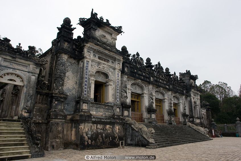
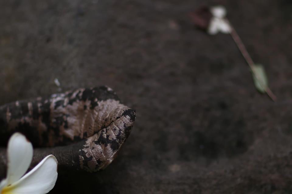
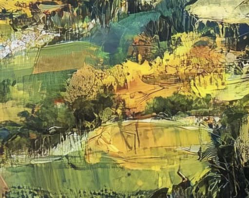
Emperor Khai Dinh utilized to infuse a sense of national identity into the architectural and artistic works of the royal court. These projects, executed during the late Nguyen dynasty, reflect a deliberate effort to adapt proactively to the changing circumstances.
Nearly a century later, the art of ceramic mosaic from the Khai Dinh era continues to flourish in temples, pagodas, shrines, and tombs.
To read the full research article below.
Next project | Self-portrait
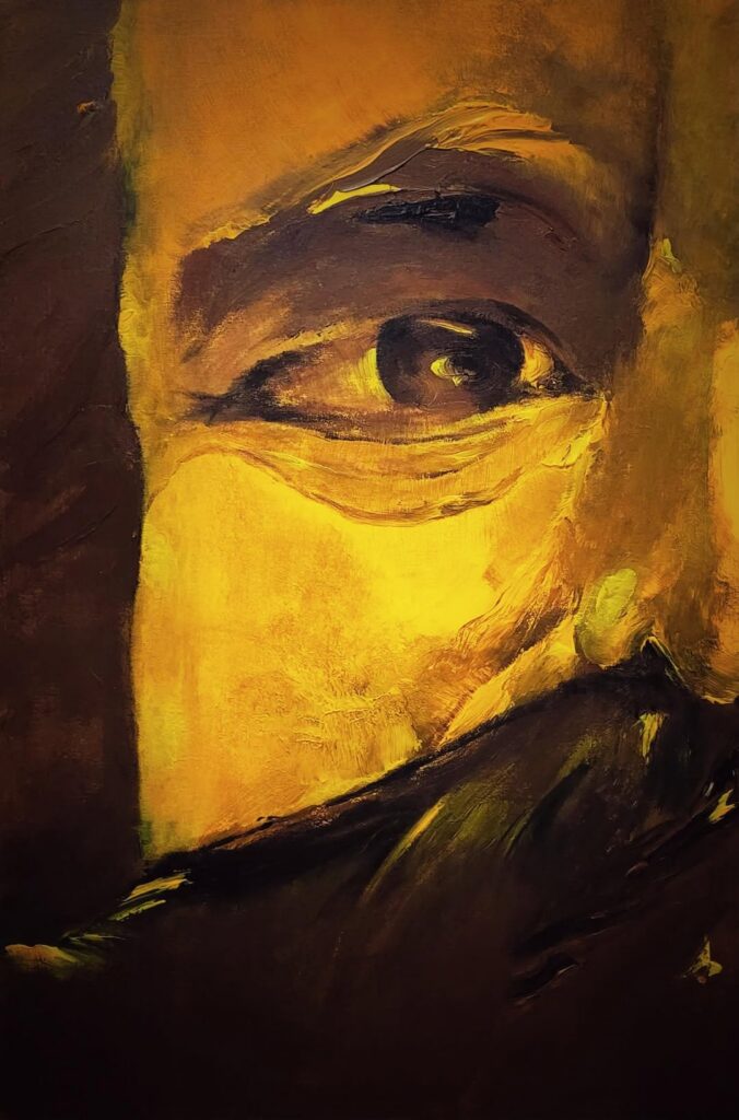
Self portrait
Vinhho
Acrylic on canvas
80x120cm
Maison d’Art
2025
Next project | Clay Pottery Gallery
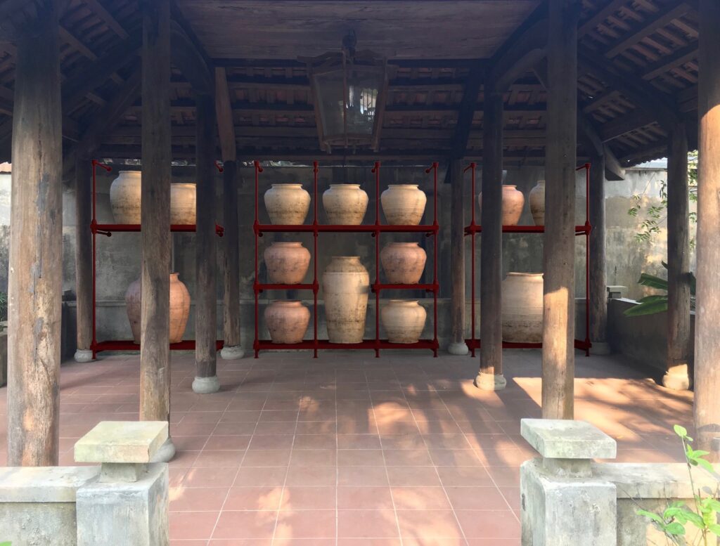
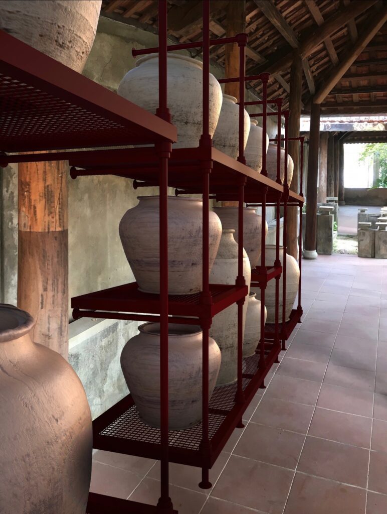
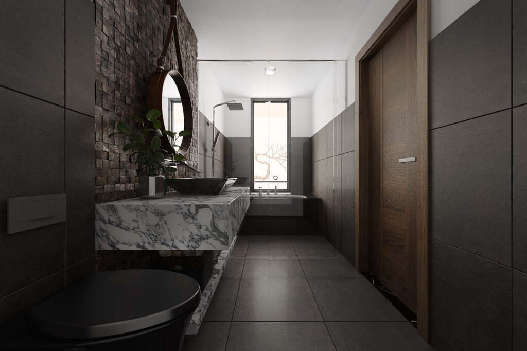
Inspired by Professor Thai Kim Lan’s collection of over 7,000 ceramic artifacts recovered from the Perfume River, the idea was conceived to restore and elevate these artifacts to reflect their true value. All ceramic products originate from the earth and are matured through fire. The intense heat of fire hardens the earth, enabling it to endure the test of time.
To symbolize this tempering quality, dark red painted steel will be used. The interplay of contrasting elements—hot and cold, hard and soft—will be applied in the design language to accentuate the significance of time and place.
Type
Art gallery
Year
2019
Project
Thai Kim Lan Garden house
Team
HVV Artchitect & Partners, Ho Viet Vinh, Tran Thu Ha
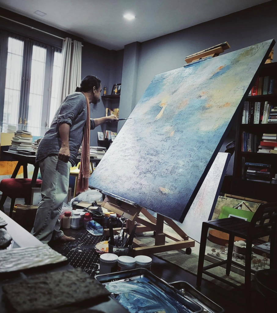
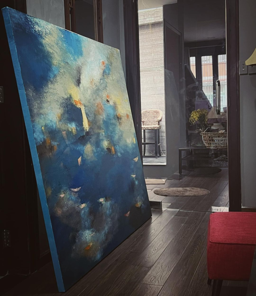
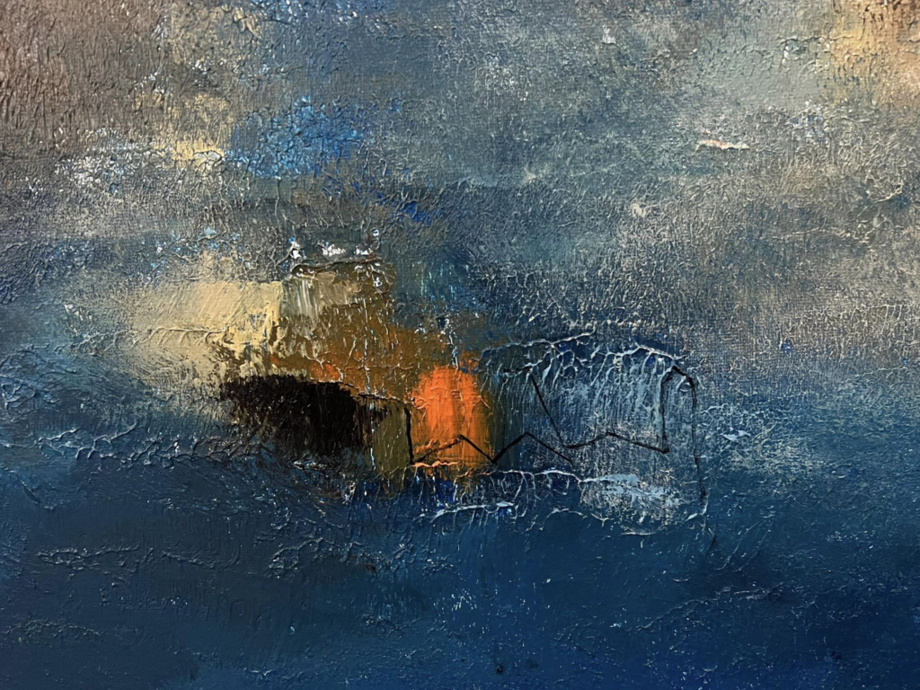
Next project | FRAGILITY
FRAGILITY
“A sea of swirling blue, evokes the tempestuous depths of the soul, adrift in a world of fleeting beauty and despair. The stark white, a beacon of hope, struggles against the relentless tide of azure, a poignant reminder of the fragility of human existence.”
Ho Viet Vinh
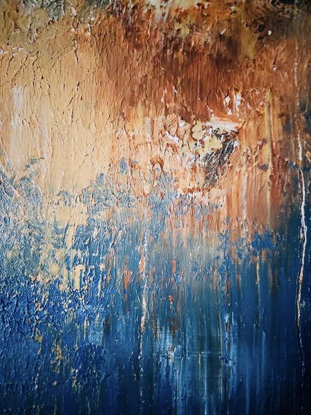
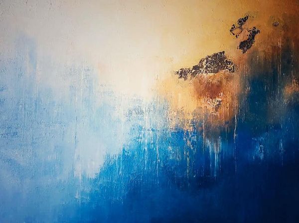
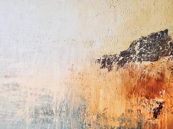
Acrylic on canvas, 130x97cm, Maison d’Art, 2024
Next project | Waterscape
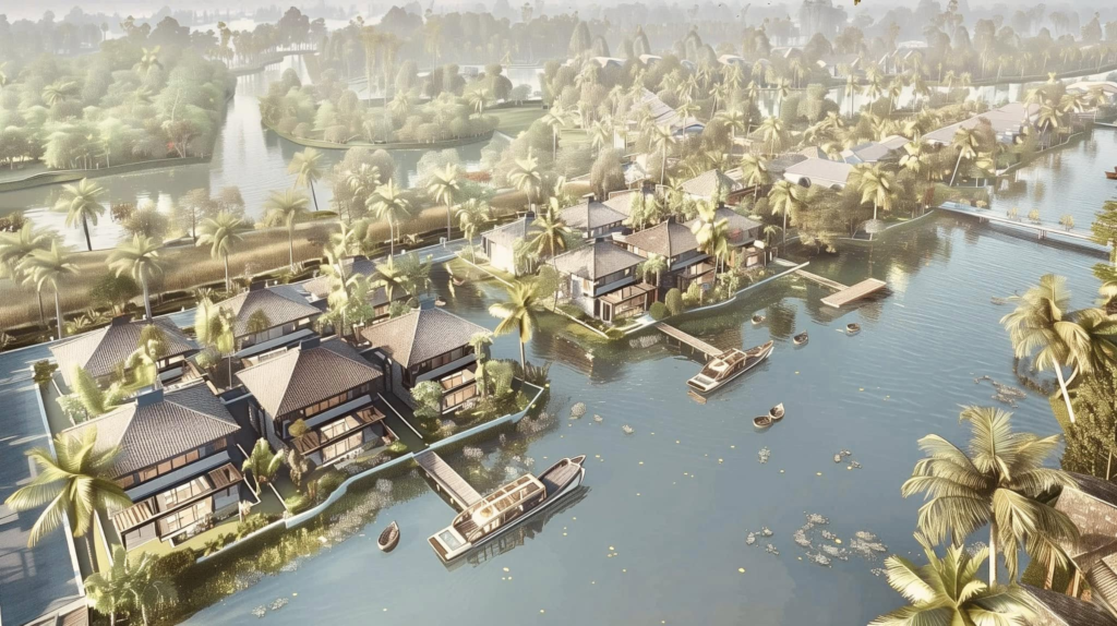
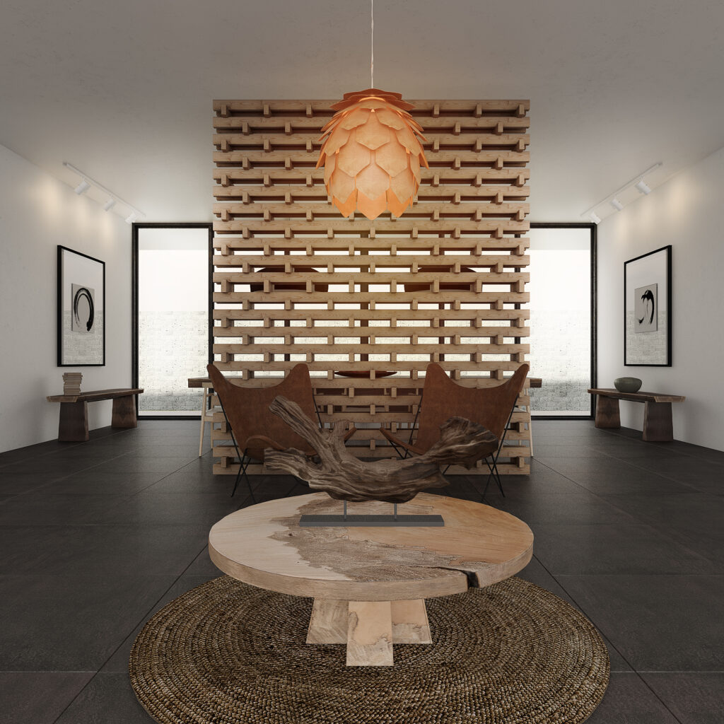
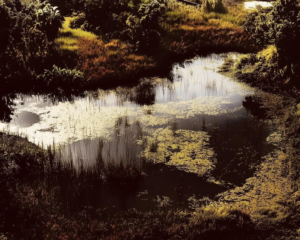
The waterscape of the living complex in the Mekong Delta beautifully embodies the harmony between architecture and nature. Drawing inspiration from the region’s rich waterway traditions, the design integrates fluid forms and organic materials that reflect the surrounding landscapes. The layout, with its interconnected waterways and lush greenery, fosters a sense of tranquility and connection to the environment. Each villa, positioned to maximize views of the water, invites natural light and breezes, enhancing the sensory experience. This approach not only celebrates local culture but also promotes sustainable living, making the project a poignant example of emotional architecture in contemporary design.
Next project | s t i l l n e s s
“If you don’t know how to relax in the pure land,
Thay Thich Nhat Hanh
A life will pass without ever touching happiness.”
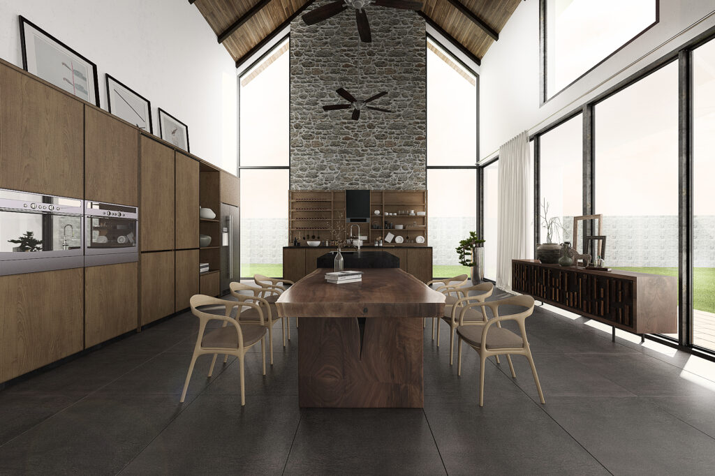
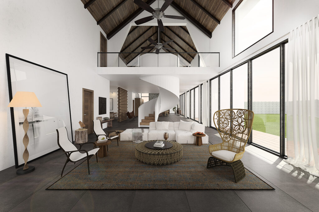
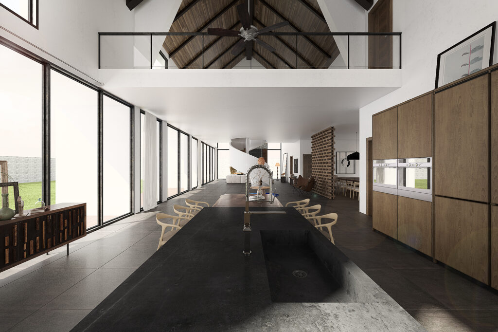
The Zen garden embodies the breath of nature, nestled in a coniferous forest that greets the morning sun and immerses itself in the cool embrace of the beach. Here, people move freely in an open space, unbound by positions or frames of reference.
Movement transcends traditional notions of inside and outside, high and low, creating a seamless unity between heaven and earth, plants, flowers, and people. Each step taken resonates with the essence of the pure land, harmonizing all into a single breath of serenity.
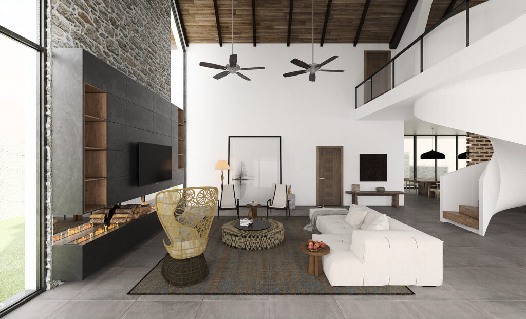
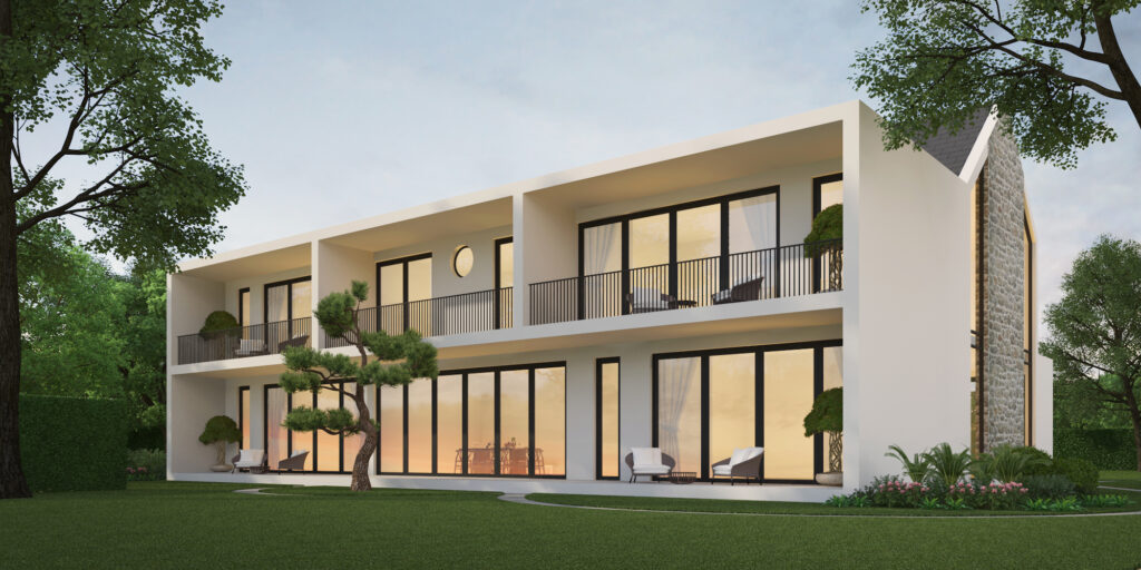
Type
Architecture design, Interior design
Year
2019
Location
Ho Tram, Vietnam
Team
Ho Viet Vinh, Tran Thanh Hai, Tran Thi Thu Ha
Collaborator
Quang Nhat Furniture, RitaVo Company, KOHLER
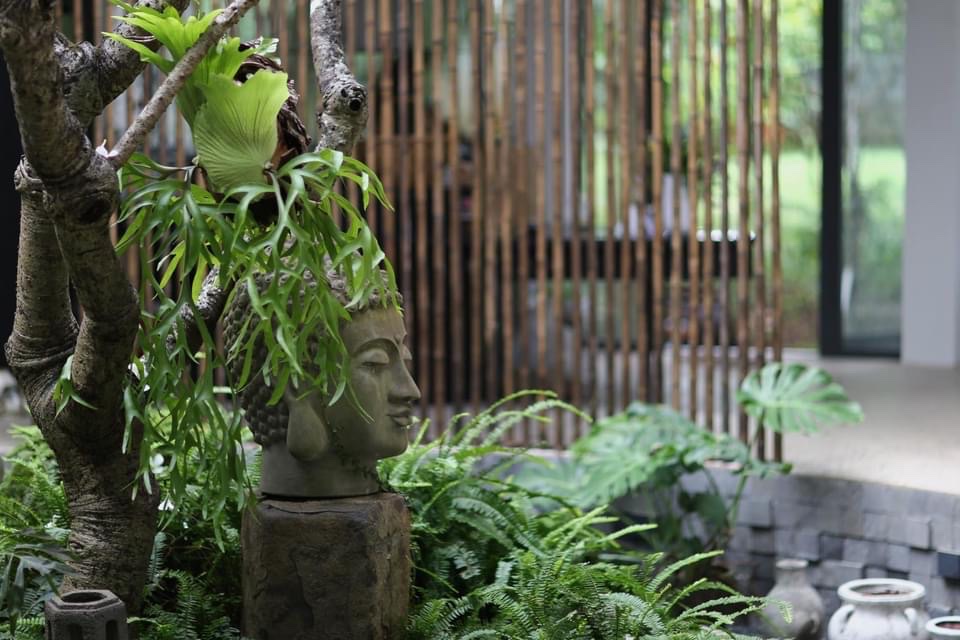
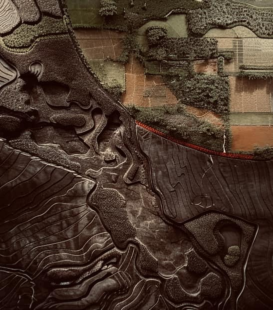
Next project | Cảnh quan bản địa
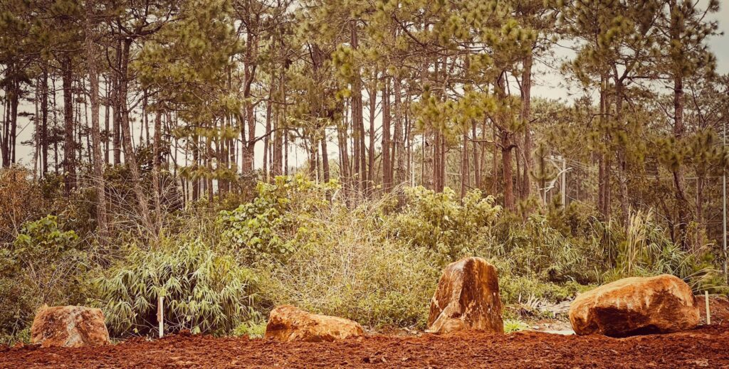
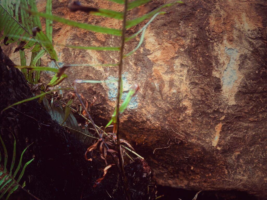
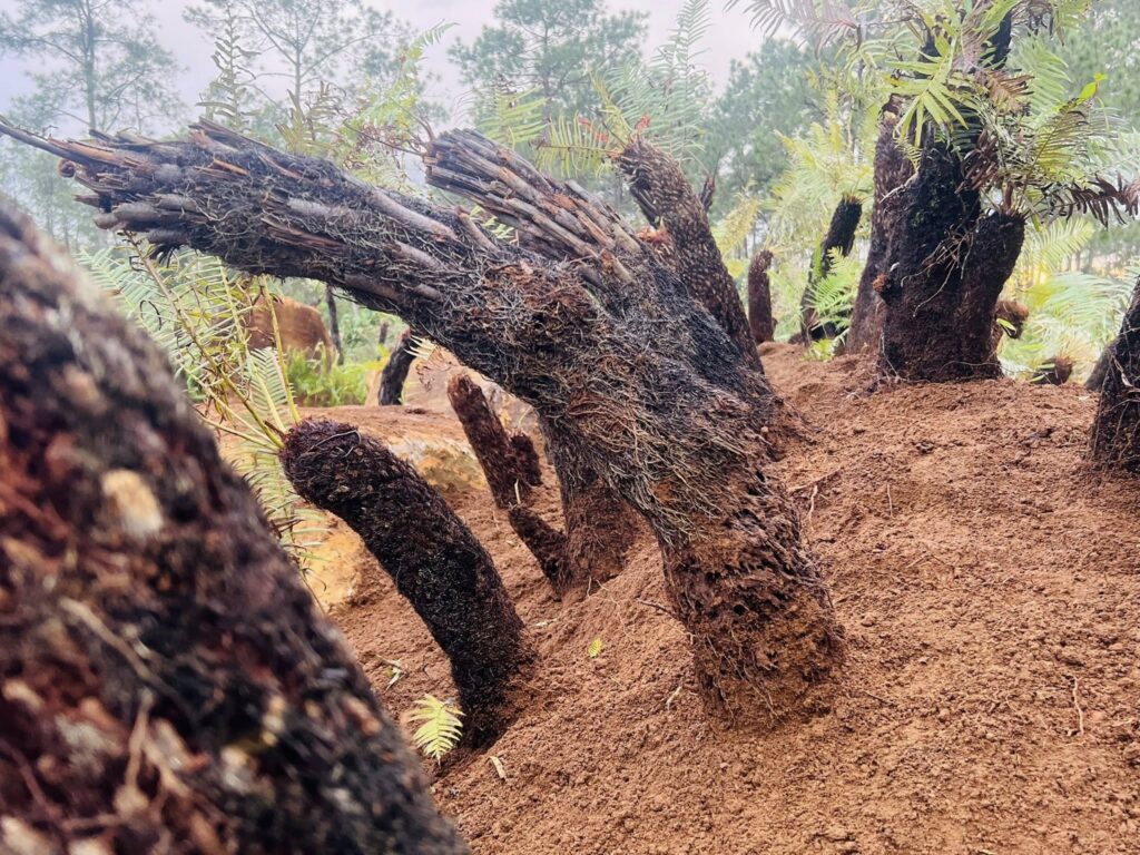
Những vệt cắt của địa tầng cảnh quan tạo cho vùng đất một tính cách riêng biệt mang âm hưởng bản địa.
Những khối đá ủ mình trong đất được ôm ấp và tâm tình với bóng đêm và làm bạn với những quân đoàn mối và côn trùng.
Những gốc dương xỉ cổ đại sần sùi, gân guốc chạm mặt ngã nghiêng hứng giọt nắng của trời để ngập ngụa trong màu xanh mơn mởn của tàng lá.
Cả ba dạng hình thái của sự sống cùng hội tụ để tạo nên ý niệm cảnh quan bản địa nơi vùng đất đầy gió và mây này.
Kiến trúc sư Hồ Viết Vinh.06122025
Next project | Peacefulness
Next project | Zen Garden
The Zen garden embodies the essence of nature, situated within a coniferous forest, where it bathes in the morning sunlight and is immersed in the cool breeze of the nearby beach. Visitors move freely within its open space, unbound by fixed positions or traditional frames of reference.
Movement transcends notions of interior and exterior, high and low. Heaven and earth, plants, flowers, and humans merge into one harmonious whole, where every step resonates with the breath of the pure land.
Next project | Hue ancient capital looks to the future
How to build Hue ancient capital city? The question has been raised since the day the Nguyen Dynasty relic in Hue was recognized as a world heritage site by Unesco, especially since the day Hue was decided by the Nation as a typical Festival City, many seminars also mentioned, but until now, no idea has been recognized. It is known that Architect Ho Viet Vinh is a Hue hometown, is teaching at the University of Architecture in Ho Chi Minh City, has done a Master’s thesis about Hue, has many construction works for Vietnam in the 21st century. He has the opportunity to study many ancient capital cities, many ancient cities of the continents of Europe, Asia, America, Australia, Africa, TTH newspaper asked him these questions.
1. TTH newspaper. New spring is coming, TTH newspaper is very happy to meet you. Knowing you are a Hue’s hometown, having studied planning and architecture of the Nguyen Dynasty, could you please tell me what you are thinking about Hue City today?
Arch.Ho Viet Vinh: Hue-The Heritage City is in the process of expanding its boundaries and transforming urban spatial structure. From a strictly ordered city on a large area stretching from the Royal Capital to the villages, gradually transitioning to an irregular and chaotic urban structure. Therefore, the disturbances in urban spatial organization are causing concerns for residents, tourists and even urban experts. An issue placed on the conference table that still has no satisfactory solution is whether this is a normal change of a Heritage City on the path of integration and development or a deviation in orientation. this particular urban development. For a valid argument, we need to go back nearly 700 years to see the treasure of Hue urban heritage values accumulated through historical periods to orient the way for the future. Hue Heritage Urban has been formed through the following stages:
• The period before 1558: the first inhabitants came to Thuan Chau land
• The period from 1558-1775: the migrations to find the land of Phu Xuan capital
• The period from 1802-1885: the plan to build the Capital has the largest scale and the most complete function in urban history.
• The period from 1885-1945: the southern expansion of the Perfume River formed a two-structure urban model: the Vietnamese quarter and the Western quarter.
• The period from 1945-1986: nature-war-planning economy (subsidy period) changed urban spatial structure towards filling urban voids.
• The period from 1986-1993: the formation of subdivisions and the isolation of the heritage in the spatial distance.
• 1993-present period: historical transformation plan to turn medium-scale urban-heritage into large-scale urban area (Thua Thien Hue City under the sixth central government of Vietnam).
Indeed, over a journey of nearly 7 centuries, Hue with its architectural appearance and heritage formed and developed over a long period of time with many historical changes has created a Hue city full of unique characteristics. distinctiveness in the cultural space of Ngu mountain-Perfume river. Hue urban structure identifies the Perfume River as the main layout axis that creates the shape of the Citadel and nurtures the human spirit of Hue. Yet the urban expansion of the late 20th and early 21st centuries has turned its back on the river, creating a pervasive urban structure, stretching and filling in precious gaps in the existing urban structure. 2. You have surveyed and studied many ancient cities, many ancient capital cities, what do you think is different from Hue compared to those ancient cities?
Arch.Ho Viet Vinh: I also had the opportunity to survey and research some heritage cities such as Kyoto-Japan, Siem Reap-Cambodia, Bali-Indonesia, Luang Phrabang-Lao, CapeTown-South Africa, Lyon-France, Casablanca-Morocco must recognize that each city has its own appearance, in harmony with the natural setting. The difference between Hue and these cities is the behavior between people and nature and between people and people. In such a way, the people of Hue have created a slow and relaxed way of life to achieve the wonderful harmony between Man and Nature.
3. What can we learn experiences from these ancient cities?
Arch.Ho Viet Vinh: These heritage cities preserve the form and spirit of the place of history at the time it was born, any interference in the development process is carefully considered not to do damage to the monument whether it is open space or landscaped terrain. The first and most valuable lesson for Hue is that the developed urban structure must accept the Perfume River as the layout axis and respect the central role of the Hue Citadel in the development in harmony with nature. The second lesson is that the concept of heritage adaptation needs to be placed in the context of the new urban environment that is a continuation between the past and the future. New construction within the influence of the heritage must inherit and highlight this continuity based on the spirit of place. Each work, cluster of works must be created based on the unique spirit of the Heritage City. Building a place must match the times, away from the habit of copying and imposing architectural models without selection.
4. How was the construction in that old city?
Arch.Ho Viet Vinh: I would like to mention the conservation and development plans of some heritage cities that Hue can refer to and study.
• The heritage city of Lyon (France): located on an oasis at the confluence of the Le Rhône and Saône rivers, the world heritage space is located on a part of this oasis and another part owned by the Saône river in the area. central position of the urban spatial structure. The traffic axes of the northern belt (péripherique du nord) and the southern belt (péripherique du sud) are located at two ends to avoid affecting this area. The enhancement of connectivity through continuous traffic axes between the historic center and the new urban area. The development model that combines the old and new structures on both sides of this river also ensures the parallel development and conservation goals of this contrasting heritage city.
• The heritage city of Venice (Italy): was selected to develop in a way that completely preserves the spatial structure based on the unique water transportation system in the world. New and old spaces are connected on the same system of canals, creating a common rhythm of spatial continuity as well as increasing the overall harmony. The modern transport system is located far away and ensures that it does not affect the completeness of the urban structure. The model that strictly preserves the compositional character has created a magical heritage city full of romance.
• Kyoto Heritage City (Japan): Kyoto Heritage City is developed sequentially and interlaced between old and new on the existing urban structure, ensuring a balance between construction and urban gaps. The city still preserves Temples-Pagodas-Temples located in the intact mountainous landscape to the east and west of the citadel built in the past, attaching the shape of religious works to the spiritual landscape of the mountains and forests. . Heritage buildings such as the Kyoto Imperial Palace, the old town, pagodas and temples are preserved intact the authenticity of history and spirit of the place. The modern urban area is harmoniously interwoven into the existing urban structure, creating a bustling atmosphere without creating pressure on the historical space.
• Amterdam Heritage City (Netherlands): The heritage city of Amterdam-Netherlands maintains a new system of co-structured canals that create a transitional space between the old urban part and the new urban part to enhance diversity. morphological form of urban space structure and ensure uniformity. 5. What factors help these ancient cities to retain their traditional characteristics while still integrating into modern times and successfully developing their economy in a sustainable way
Arch.Ho Viet Vinh: As I mentioned above, these heritage cities always respect the historical value created by previous generations, even though there are differences in views and attitudes towards the historical role. its history. After all, Heritage is the crystallization of the values and efforts of the community on the ideological foundation of the ruling class, so preserving the heritage is like preserving the nation’s treasure for future generations. thinking and shaping the way for the future. Therefore, there is no antagonism between Conservation and development, conservation is the foundation of development and vice versa, development creates conditions for better conservation. The city is a living entity that moves and develops over time, the architectural heritage that is a component of it also moves and develops. Although the heritage itself does not change, the changing environment leads to a different perception of the heritage and becomes more and more attractive and valuable. Therefore, to manage the Heritage City, it also needs good, enthusiastic and brave people to make appropriate development policies and exploit the treasure value to serve humanity in the spirit of UNESCO, because The reason is that the Heritage is “unique”, there must be a “unique” Person to govern.
6. In order to get rid of the current stagnant situation, what should Hue ancient capital city do to look forward to the future where it can stand side by side with ancient cities in the region and in the world?
Arch.Ho Viet Vinh: In my opinion, it’s time to carry out a plan to rebuild the Heritage City based on the new idea of a Hue City – 21st Century (referred to as Hue 21) developed in parallel with the Citadel. The heritage street in the continuity relationship receives the Perfume River as the main layout axis. This idea will help the Heritage City to escape from the “oil slick” development model of most urban areas in Vietnam, the consequences of which are the encroachment and distortion of historical spaces. In my Master’s thesis on Hue in 2001, I also outlined the shape of the spatial structure of Hue City in the 21st century with a linear urban model (about 8km in length and 2km in average width) located in the center of the city. symmetrically with the Citadel through the lower part of the Perfume River with an area of about 1600 ha. The driving force of urban development extends 8km towards Thuan An estuary, this is an ecological avenue with modern landscapes combined with a network of rivers and canals spreading to the lower Huong River to create a new balance. between modern architectural works surrounded by village ecological environment. The waterways perpendicular to this boulevard were dug up to raise the foundation for construction areas according to traditional feng shui principles.
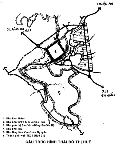
The urban structure is built according to the 21st century ecological urban model, suitable for new lifestyles and modes of living in order to complete the function of the Heritage City in the future. The concept of Landscape Urban (Paysage urbaine) of heritage city goes hand in hand with the concept of Village Urban (Village urbaine) of the 21st century – An era aimed at protecting the environment and improving the quality of life, perhaps the right choice for the future Hue (see outline diagram).
7. In your opinion, what has kept Hue City from developing? How to overcome that?
Arch.Ho Viet Vinh: Hue urban architectural heritage is the diversity of spatial forms formed through historical periods, including: the system of Palace and Palace of the Nguyen Chua, Thanh Ha commercial port area, and neighborhoods. Bao Vinh town, Imperial City area, Nguyen King’s Tomb area, east commercial area of the Citadel, Kim Long-Vi Da garden house, Western quarter, multi-functional commercial street formed on the background of the locality. Spatial morphology of the Nui Ngu-Perfume River region. However, due to many reasons, the urban heritage fund is being degraded due to the invasion of time and the lack of human intervention. Even the efforts to restore and recreate the heritage in the region are expensive but do not bring vitality to the monument, in addition, the new construction without a strategic vision is turning Hue into a “popular city”. . According to a survey of tourists who come to Hue for the first time, they do not want to return because the attractiveness of the Heritage City is dwindling. Therefore, Hue Heritage City is currently losing its attractiveness in the competition between domestic and international heritage cities, statistics show this correlation:
• Kyoto-Japan Heritage City has a natural area of 827 square kilometers, a population of 1,473,746 people, and an annual number of tourists 30 million, of which about 1.2 million are international visitors.
• The Bali-Indonesia heritage city has a natural area of 5,780 km2, a population of 4,225,384 people, the number of international tourists 3.5 million.
• The heritage city of Siem Reap-Cambodia has a natural area of 10,299 km2, a population of 896,309 people, and the number of international visitors 1.6 million.
• The Hue-Vietnam Heritage City has a natural area of 5,062 km2, a population of 1,115,523, the number of visitors 2.4 million, of which about 0.9 million are international visitors.
The most common point is that the main economic activities of these Heritage Cities are tourism and activities related to exploiting tourism services to serve and satisfy visitors. In the competition for attractive destinations, the Cities will attract tourists and ensure an annual growth of over 10%. Many conferences and seminars have mentioned the weakness of Hue tourism industry and pointed out many reasons leading to this situation, but two important factors can be clearly seen: in planning The economic development strategy of Thua Thien Province has not yet considered tourism as a spearhead economic sector and has not had suitable measures to enhance the attractiveness of tourism products to serve the needs of domestic and foreign tourists. countries in competition with destinations in the region and the world. Although Hue is a national festival city, cultural activities are held every 2 years in the form of theatrical organization which is difficult to attract people and tourists. In addition, people still stay out of these festival activities because the organization is still heavily directed by the government and lacks the encouragement of participation from the local community – an important factor. keep the soul of cultural festivals in Heritage Cities.
8. In your opinion, to attract Hue people and Hue lovers outside Hue, what should Hue City do?
Arch.Ho Viet Vinh: The 21st century is the era of a knowledge-based economy in which the role of good and dedicated professionals is respected and created favorable conditions for dedication. Hue is the land of talented people, so many outstanding Vietnamese people have lived, studied, worked and fell in love with Hue. Having the opportunity to live and work in this Nervous land must be the dream of young intellectuals to fulfill their future ambitions. The important issue that Hue leaders must do is to seek advice and truly respect and trust to entrust important tasks to the next generation, rather than looking for people with many qualifications. In order to help Hue in the construction of the ancient capital city, one must have vision (knowledge of the ancient city), heart (love Hue), and even money. In order to attract that partner, in Hue, it is necessary to have an equal leadership team, have specific regulations, have appropriate policies, and have strong charismatic people (Hue people in Hue do not lack these people). ) Help.
9. Thank you Mr.Ho Viet Vinh
Next project | Garden of Eden
Garden of Eden
The Garden of Eden is an embodiment of the invisible woven into the fabric of existence. Its design reflects a poetic dialogue where nature’s abstraction meets architectural form. The undulating lines and textured surfaces echo the silent whispers of the earth, creating a harmonious interplay between light and shadow. This spatial composition blurs the boundaries of the tangible, inviting contemplation of the unseen. Through the use of natural materials and organic forms, the garden becomes a sanctuary of tranquility, mirroring the serene and introspective essence of the divine landscape.
HVV Architect & Partners with AI supported