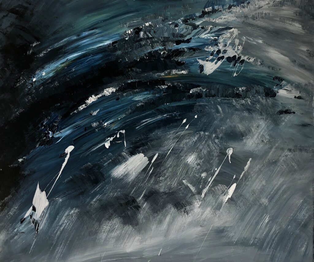
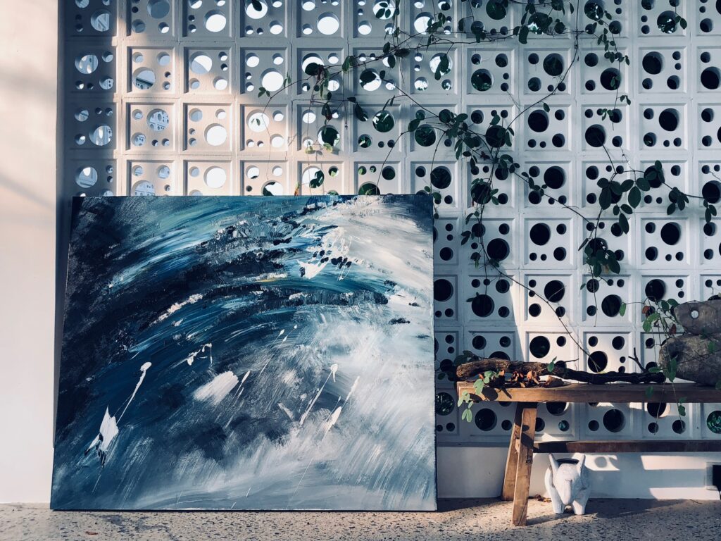
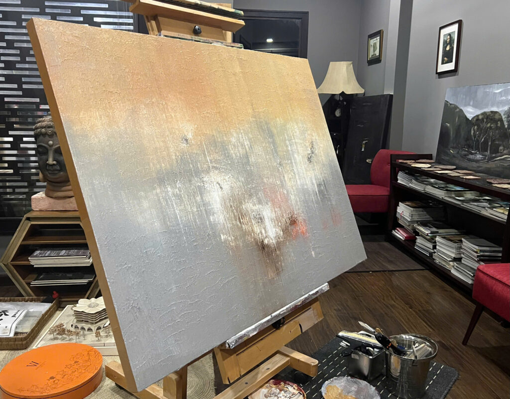
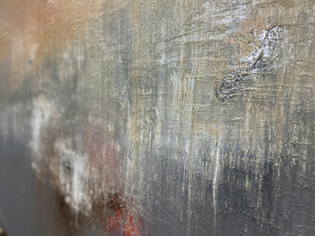
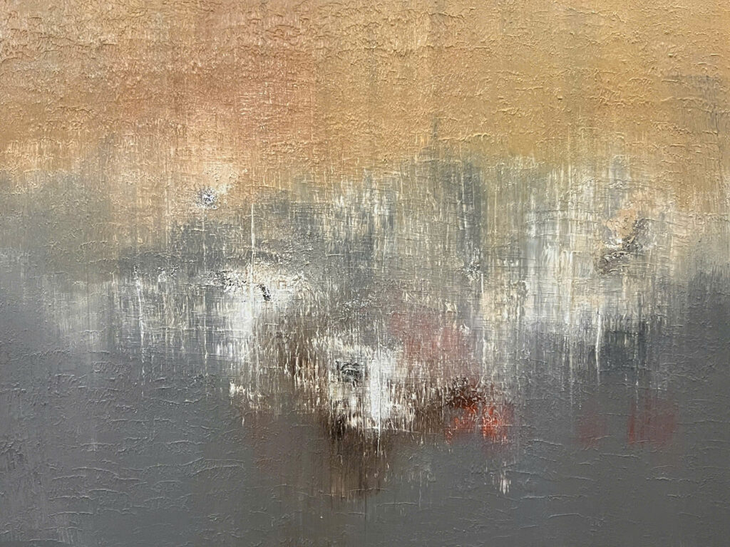
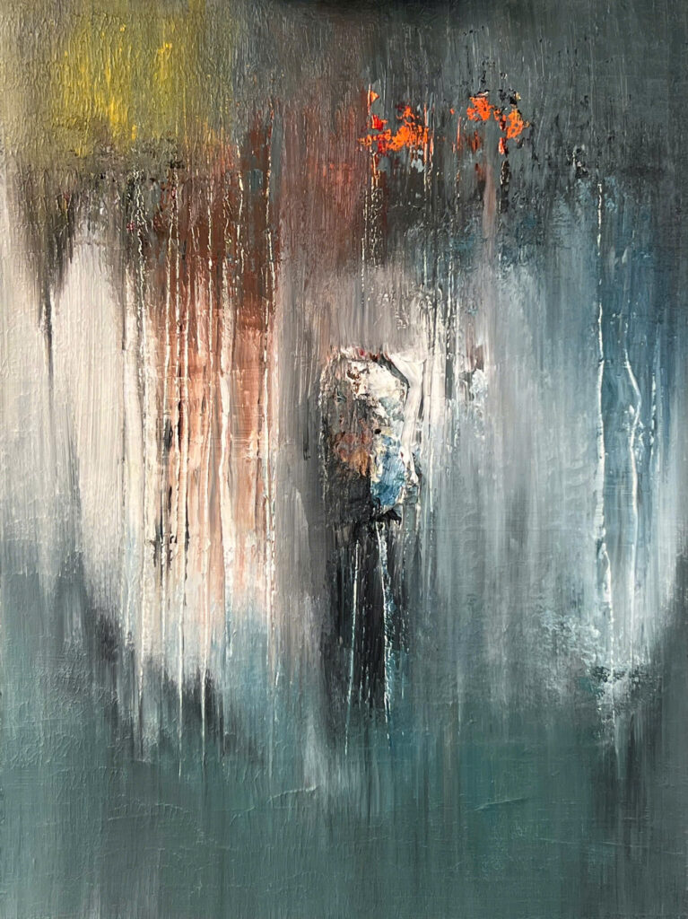
Cape of Rapids
Ho Viet Vinh
Waves filled with clouds, letting time drift by on the cape of rapids. The cape stretches out to await the sunset, ignoring the trembling sands as the tide rises.
Description
Exucuted in April 2020
Style
Lyrical Abstract
Technique
Acrylic on Canvas
Dimension
100W x 100H x 5D cm
The authenticity of this work has been confirmed by HVV Architect &Partners. A certificate of authenticity maybe delivered by the Company upon request to the buyer.
Next project | The VIDE Villa
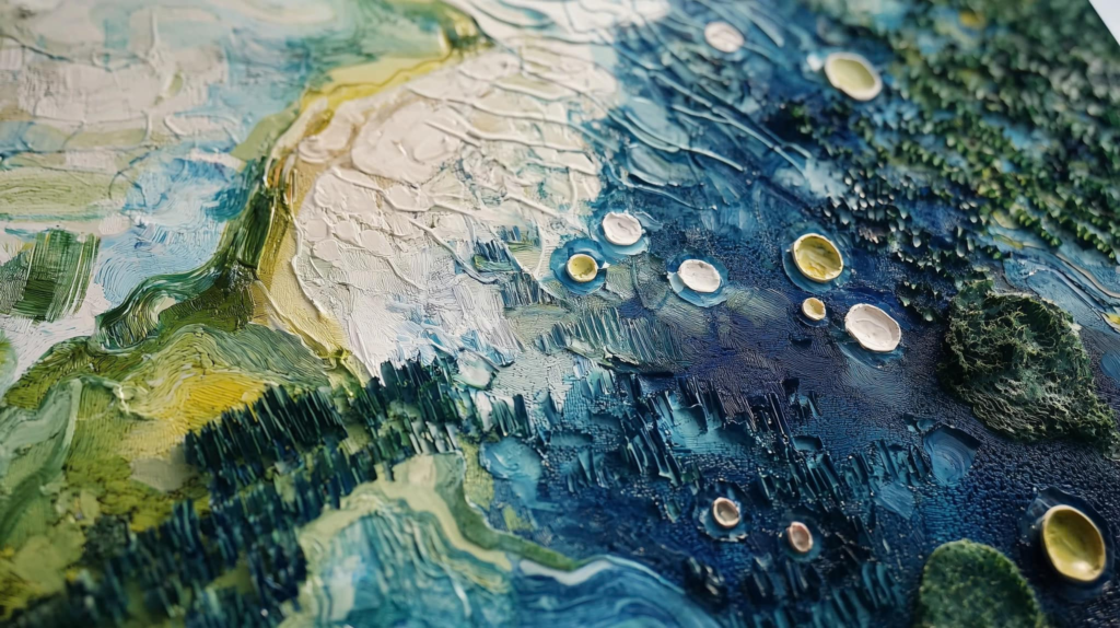
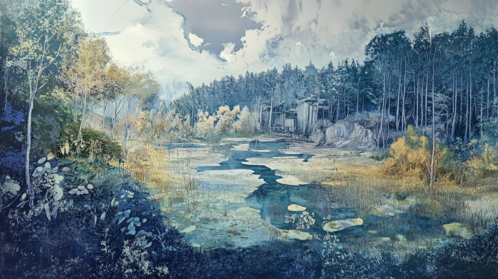
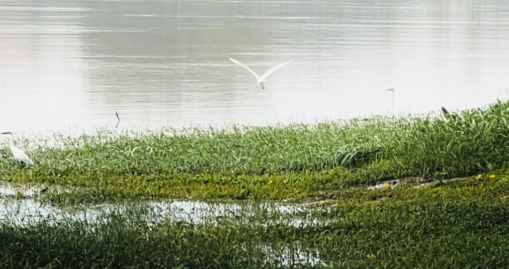
Next project | Suối Rao
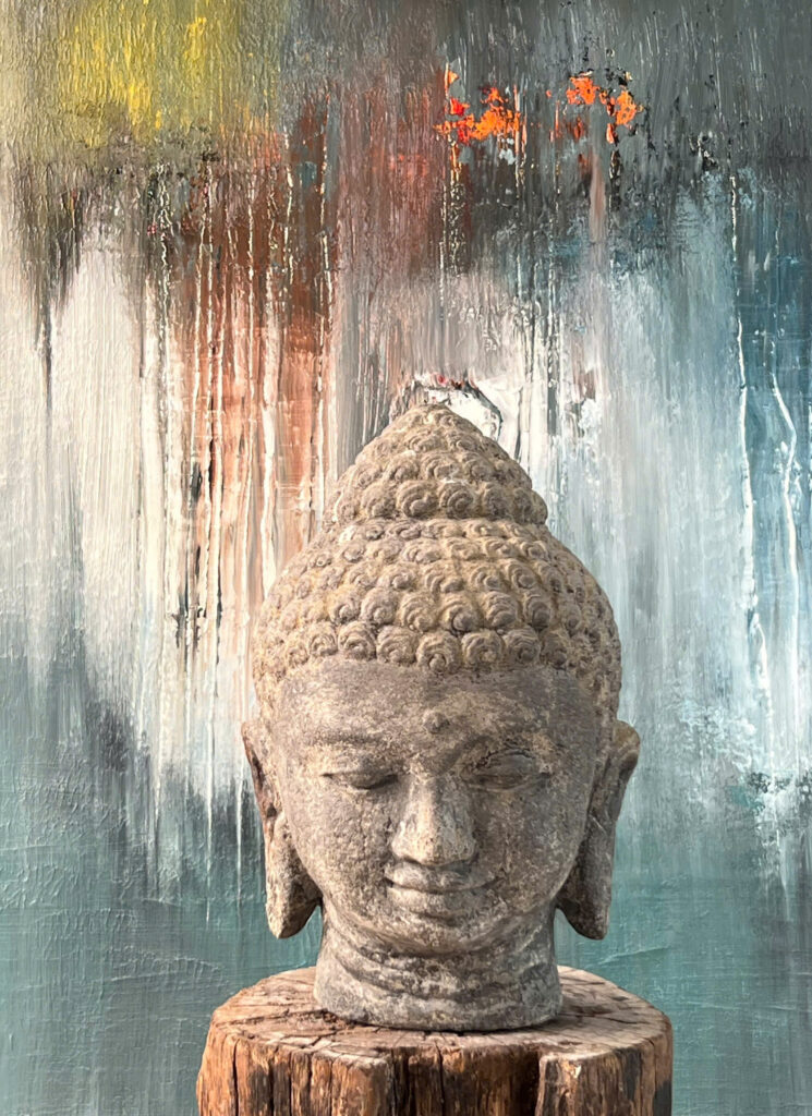
Photo by Vinhho, Maison de l’Eau
Suối vẫn reo theo nhịp của thời cuộc để âm thầm vá víu những thương tổn hiện sinh.
Dòng nước nương nhờ địa thế len lỏi tự do toả vết tràn ngập, biến cả khung trời rộng lớn nằm gọn trong chiếc bát ngửa mặt nhìn mây. Tiếng lách tách của cá đớp nước, tiếng va đập vào nhánh củi khô, tiếng gió reo lăn tăn phủ bạc lấp lánh soi bóng cả một khoảng rừng non, tiếng vỗ không thành tiếng của loài cò trắng trên mặt nước, thong thả tìm cơ hội trong cuộc mưu sinh đầy nghiệt ngã. Trong cái nắng nhẹ một buổi chớm đông, nhịp chảy âm thầm vọng ra từ thân cầu dẫn nước (aquaduct) tạo nên một hoà âm đầy tĩnh lặng.
Kiến trúc sư Hồ Viết Vinh.30112025
Next project | Lotus
Ngẩng đầu nghe gió hát,
Ho Viet Vinh
Tắm mát mạch nguồn khơi,
Chơi vơi miền êm ả,
Nghiêng ngã một đời không?
Next project | Nostalgia
“The gentle interplay of light and shadow dances across the room, reminiscent of a fading memory. Each element, from the plush seating to the artful arrangement of books, whispers stories of bygone days. The warmth of wood and fabric envelops the senses, creating a cocoon of comfort and reflection. This harmonious blend of textures and hues captures the essence of nostalgia, a poetic journey through time, where beauty and melancholy coexist in a delicate balance.”

Next project | Cloud
Solid and rough are the emotions of BaoLoc. Spatial topography consists of interlaced hills, layers hidden under layers of cold pine forests. In that autumn silence, the clouds are the witch who transforms to soften the rough, dry and cold.
CLOUD
Vinhho.2022
Following the wind, the stream flows in all directions,
The foggy road is dotted with flying dew drops.
Love is drunk at night in dreams,
Filled with the call of the human realm.
Next project | FRAGILE
Fragile
“The quiet beauty and subtle melancholy, reflecting the fragility of life and the passage of time, enhancing the sense of fragility and evoking a sense of wonder and contemplation.”
Ho Viet Vinh
Fragile, Acrylic on canvas, 130x97cm, Maison d’Art 2024
Maison d'Art
The fragility of life and the passage of time
The quiet beauty and subtle melancholy
Next project | INVISIBLE
Invisible, Vinhho, Acrylic on canvas, 60×80, Maison de Corail, 2024
The overlapping layers of color create emotional and material depth, symbolizing disintegration and rebirth. The contrast between light and darkness, emphasizes the struggle between hope and suffering, opening up an abstract space rich in philosophical reflections on existence and history.
Next project | Naked Garden
A symphony of earth and water that whispers of hidden desires. This enchanting scene blurs the line between reality and illusion, inviting the viewer into a realm of sublime beauty. The interplay of light and shadow evokes a sense of eternal mystery, reflecting the poet’s fascination with the ephemeral and the divine. It is a mesmerizing vision of a garden stripped bare, revealing the seductive essence of nature’s true form.

HVV Architect & Partners with AI supported
Next project | Tự tại
Êm đềm tựa giọt sương tinh khiết gieo mầm an lành.
Can trường cắm cội rễ sâu bền trước bão lũ.
Hoa trôi nở hương thơm giữa dòng nổi sóng, bờ cỏ lặng lẽ tựa mặt hồ thu.
Hương Giang trở thành ngọn đuốc chánh niệm – vừa tỏa sáng tự thân, vừa soi đường dẫn lối.
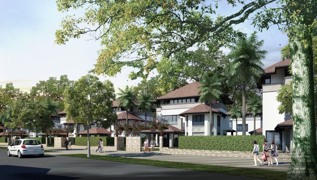
Next project | Marina Saigon Villa
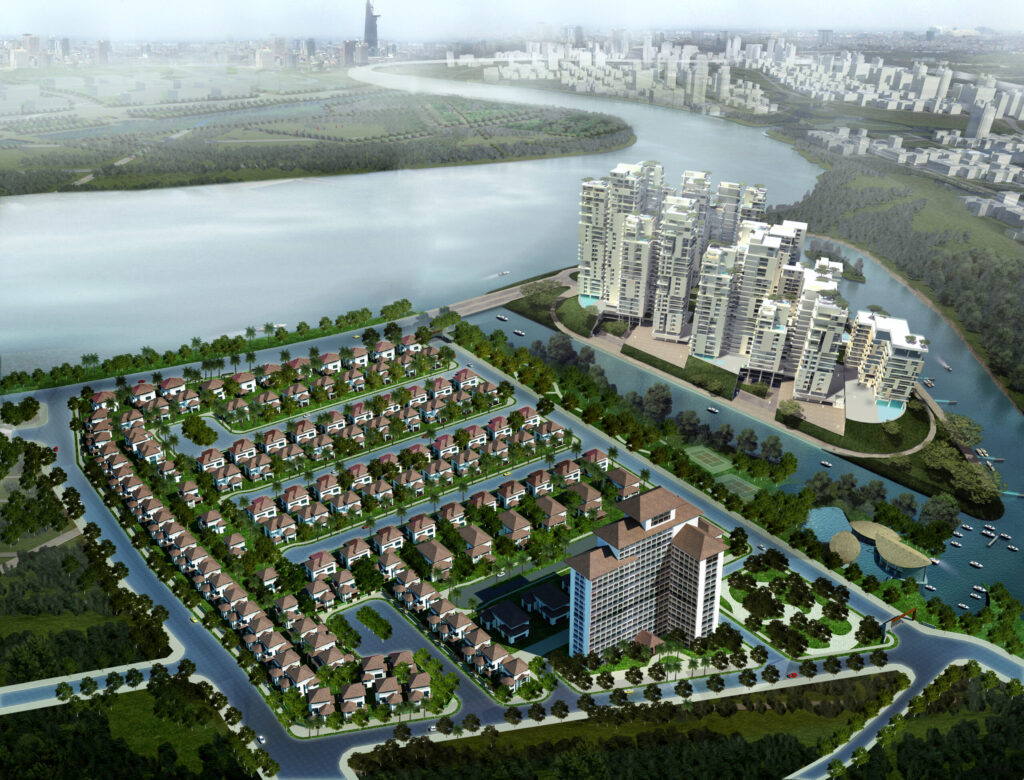
The marina lifestyle has its own allure, and life at Marina Saigon Villa elevates it to a unique experience, allowing you to savor life your way. Even if you’ve never owned a yacht before, you’ll seamlessly join the circle of enthusiasts reminiscent of 19th-century European aristocrats.
From the marina, where every villa boasts its own sparkling turquoise sails, you can personally navigate your yacht to capture moments of emotional conquest and freedom.
Each time you step aboard, you’ll realize that time ceases to be an obstacle. Whether heading to the trading center or the stock exchange in the heart of Saigon Trade Center, the journey is effortless.
In just a few minutes, you’ll arrive at your favorite golf course. Within 30 minutes, you can sail across the Saigon River to breathe the fresh air of Can Gio, a UNESCO Biosphere Reserve, or head upstream to explore the historic Cu Chi tunnels—or venture anywhere your heart desires.
Experience the unparalleled beauty of the vast riverscape and open skies, where every journey is an adventure waiting to unfold.
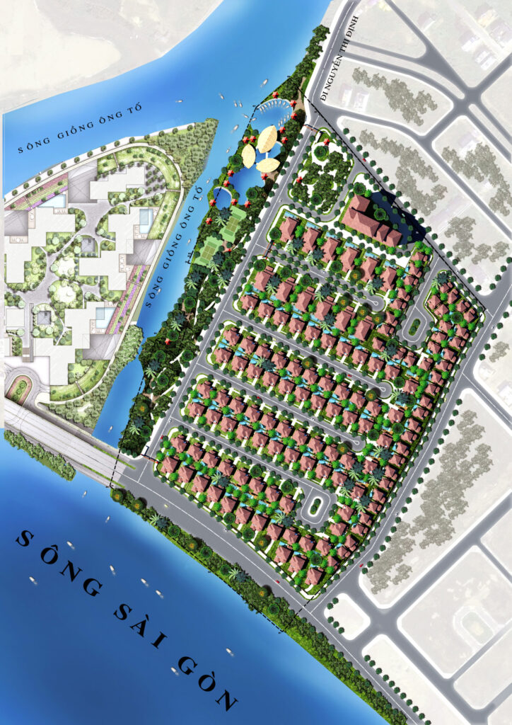
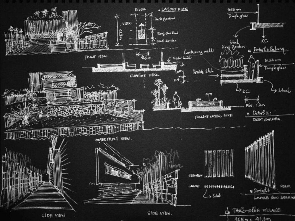
Type
Residential
Year
2015
Area
20 hectares
Location
District 2, Ho Chi Minh City
Team
Ho Viet Vinh
Tran Thanh Hai
Nguyen Dinh Nhat Thu
Truong Anh Thu