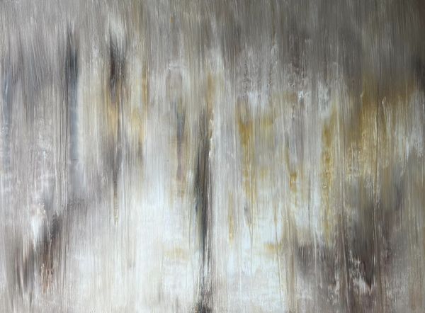
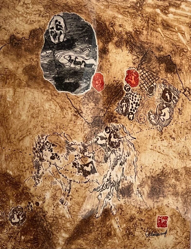
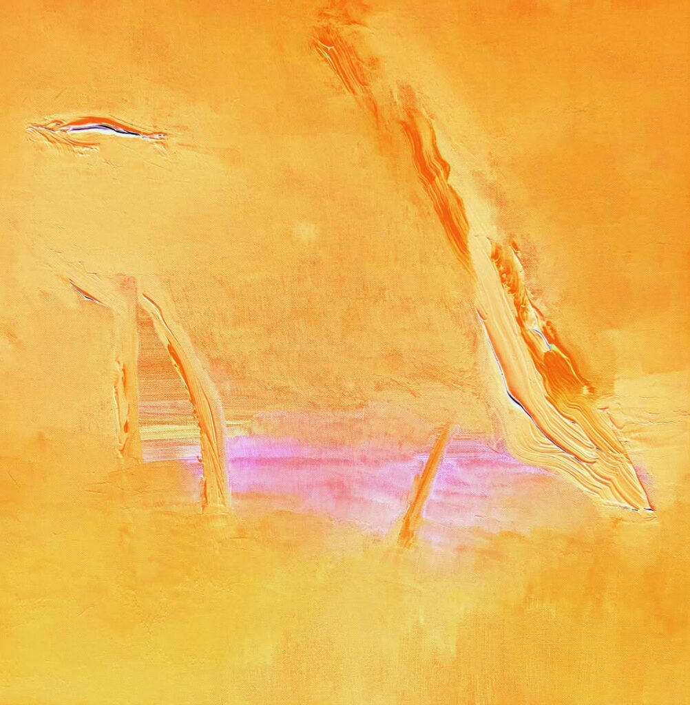
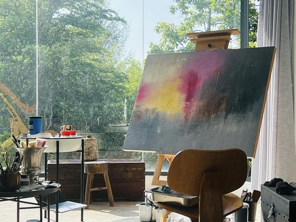
Vinhho, Acrylic on canvas, 130x97cm, Maison de Corail, 2024
“The interplay of dark and light hues conjures a spectral dance of shadows, evoking the elusive nature of the intangible, whispers of the hidden dimensions that lie beneath the surface, suggesting an eternal struggle between presence and absence.”
Ho Viet Vinh
Next project | Le Ba Dang Art Space
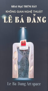
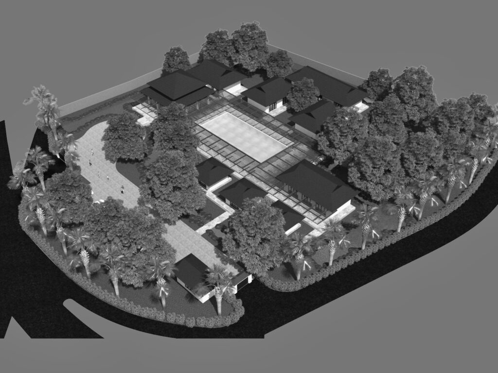
At the end of November 2024, the Ho Chi Minh City Museum of Fine Arts launched the Le Ba Dang Art Space exhibition. The exhibition not only aims to showcase the distinctive creative values of painter Le Ba Dang but also serves as a tribute to the generosity of Mr. Le Tat Luyen and Mrs. Thuy Khue, who donated this collection. Their contribution has played a crucial role in preserving and promoting the value of this artistic heritage while fostering the creation of a vibrant art space that inspires future generations.
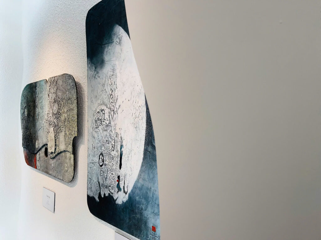
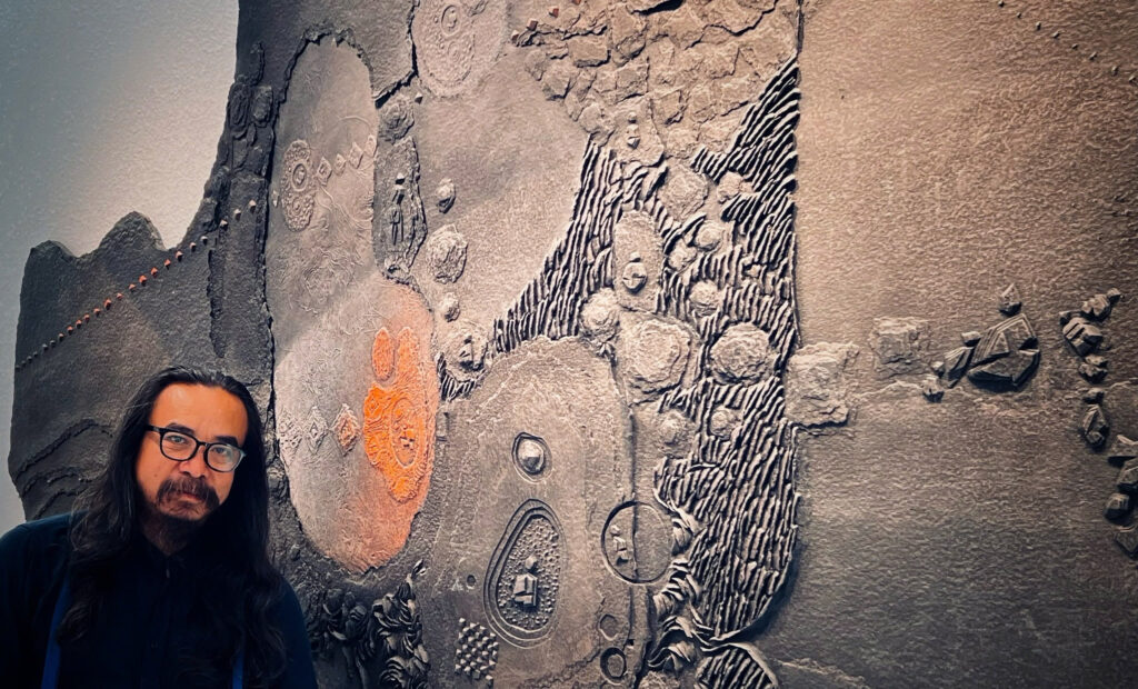
“The famous painter Le Ba Dang has woven brocade and embroidered the beauty of the country and the Vietnamese soul with a new and unique language of painting.”
Architect Ho Viet Vinh
Next project | The Ambiguity Space
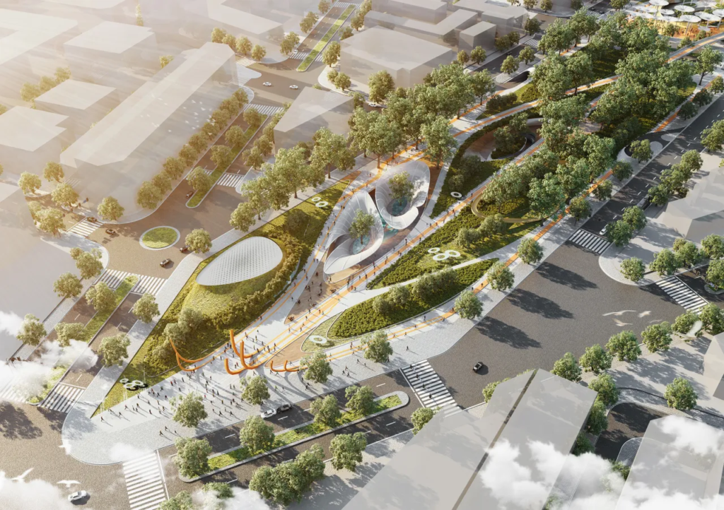
Next project | Thien An Community Park
Thien An Community Park, Hue symbolizes the exchange process among communities settling in a new land. They bring with them vast knowledge, unique customs, and aspirations to build a life in this new place. The community serves as a space for openness, exchange, learning, and growth. The process of convergence, interaction, and experimentation among these communities has shaped a distinctive character for the culture of the historic ancient capital.
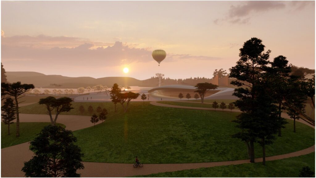
The park recreates the process of community formation through five main spaces:
- Meeting Space
- Exchange Space
- Agglomeration Space
- Experimental Space
- Performance Space
Each space embodies a unique form and function, representing a distinct stage in the process of community and cultural exchange.
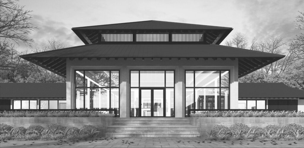
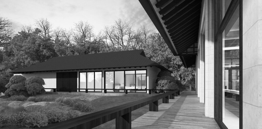
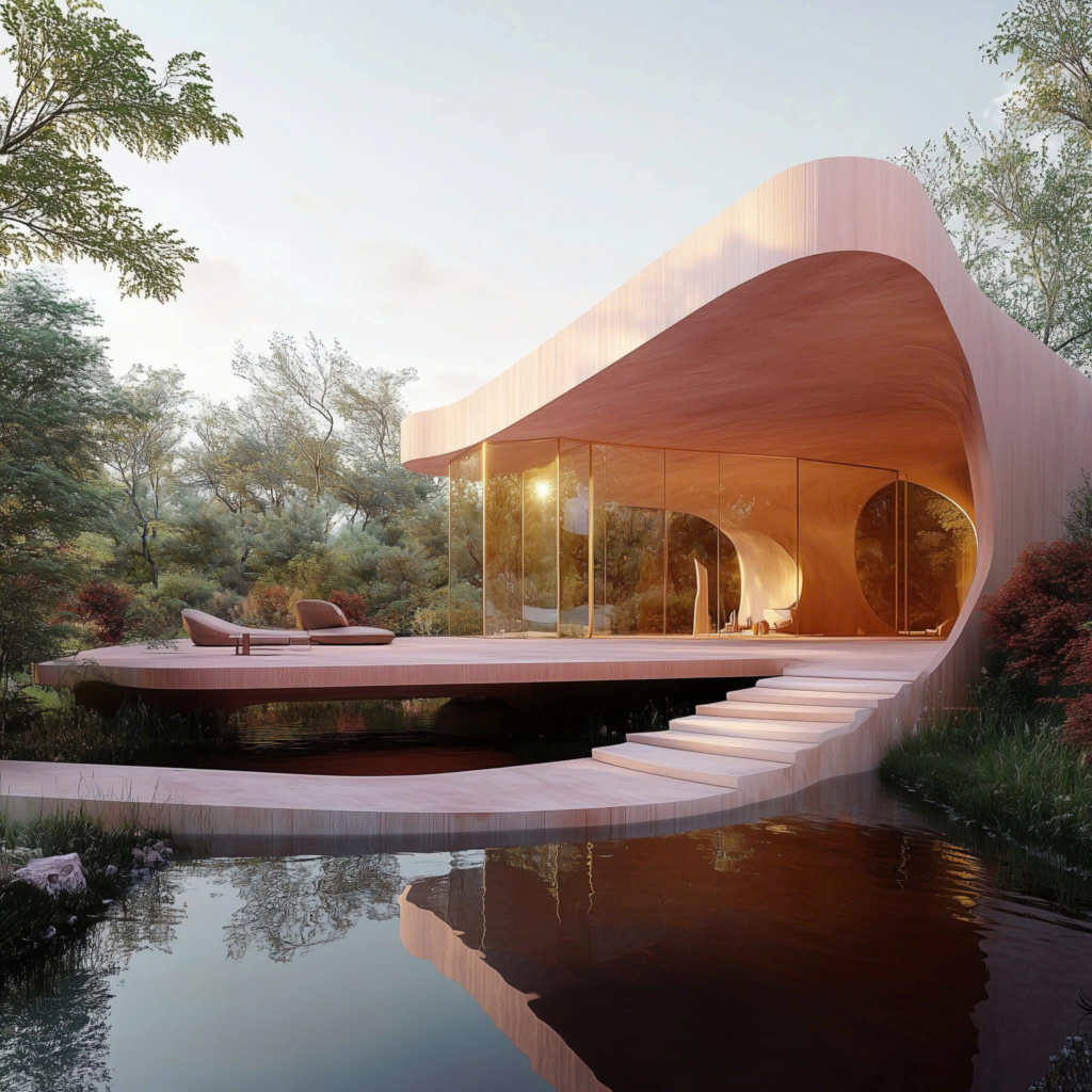
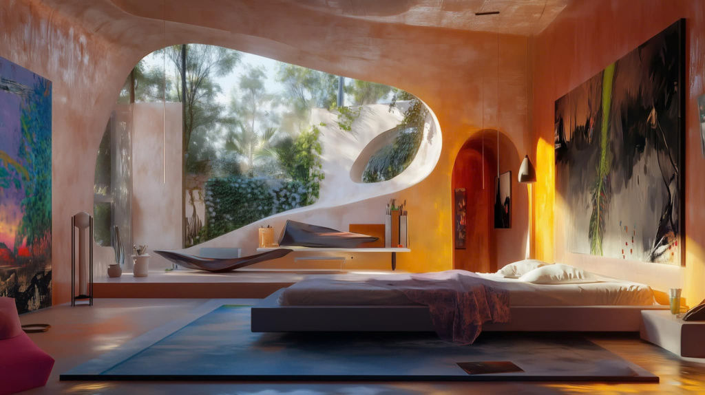
Next project | Maison de L’eau
Nestled gracefully above tranquil waters, Maison de l’Eau embodies the harmonious blend of modern architecture and nature. Its unique curved design, crafted from warm wood, invites sunlight to dance through expansive windows, offering breathtaking views of the surrounding forest. This serene retreat not only provides a peaceful sanctuary but also celebrates sustainable living, encouraging a deep connection with the environment. Maison de l’Eau stands as a testament to the beauty of simplicity, where every curve and corner reflects the gentle flow of nature, creating a perfect balance between comfort and elegance.
Next project | Vietnam’s new biophilic architecture is going wild
Picture architecture in Vietnam and you might imagine ancient temples buried down countryside lanes or faded colonial buildings lining the city streets. But spurred by unprecedented economic growth, this Southeast Asian country of almost 100 million is revamping its traditional image – and architecture is part of the overhaul. After decades spent trying to keep Vietnam’s unrelenting jungles out of the cities, visionary architects now harness the wilderness to enhance their urban creations. And the countryside is no longer designated for relics of the past – but also innovations for the future. From contemporary art hubs hiding in the hills to city tower blocks blooming with foliage, here is the architecture that is making its mark on Vietnam.
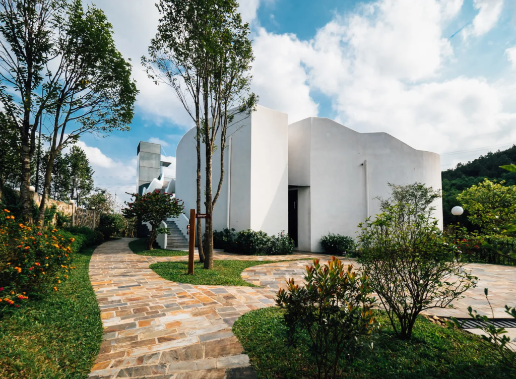
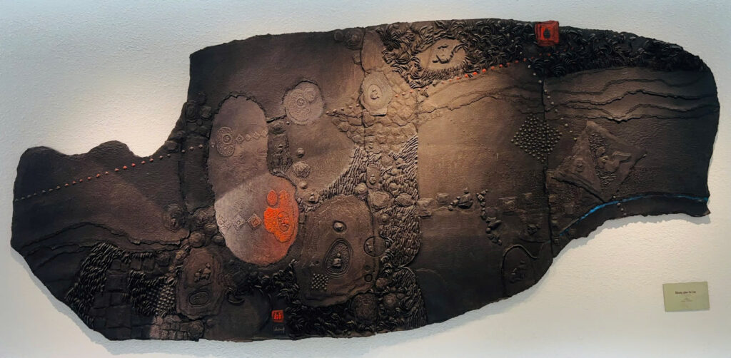
Lebadang Memory Space, by Architect Ho Viet Vinh
Nestled in the countryside together with Hue’s centuries-old royal tombs, Lebadang Memory Space is a lively architectural update to the city’s monarchical heritage. This contemporary art museum is dedicated to late local artist Le Ba Dang, who sketched the drawing that the blueprints are based on. Local architect Ho Viet Vinh designed the structure, completed in April 2019, with a central skylight that allows beams of light to track through the exhibition hall throughout the day.
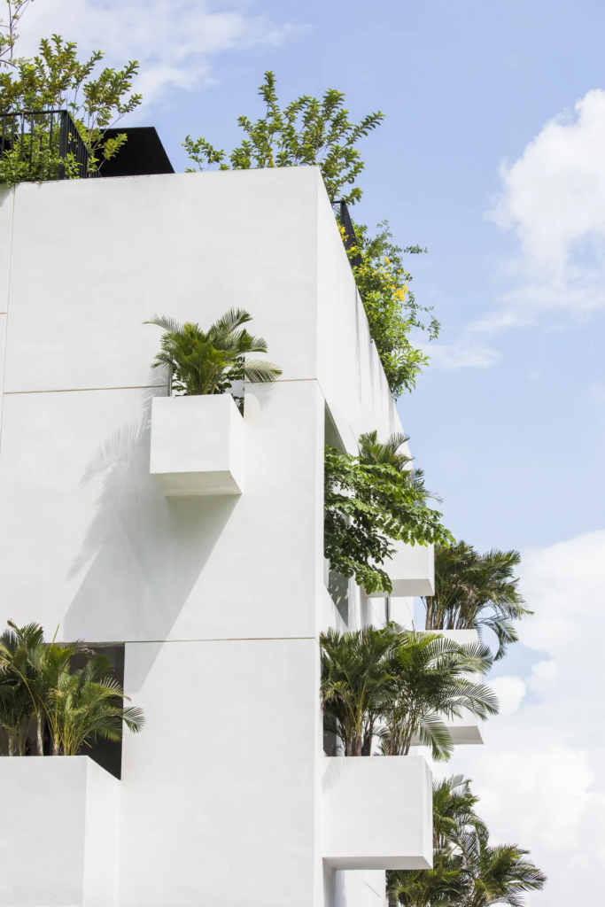
Sky House by MIA Design Studio
Vegetation bulges from the balconies and rooftops of Sky House, a home in Ho Chi Minh City completed in December 2019. The plot was spacious enough to accommodate a large townhouse, but instead of creating unrequired rooms, MIA Design Studio designated half the house to light, wind, water and trees. The result is a generous sky well that feeds light to the habitable rooms and chambers with no practical purpose but to house plants, trees, and indoor ponds.
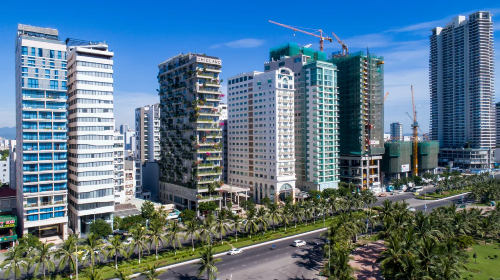
Chicland, by Vo Trong Nghia
Award-winning architect Vo Trong Nghia is celebrated for his use of natural materials and foliage, such as bamboo and tropical plants. The 21-floor Chicland Hotel, completed in June 2019 in the modern seaside city of Danang, features both. The on-site café has earthy bamboo interiors while the balconies overflow with greenery. Similarly biophilic, Vo Trong Nghia’s Silver Cloud, slated for completion later this year, is a leafy long-stay hotel that blends with the lakes and mountains of Cuc Phuong National Park, 100km south of Hanoi.
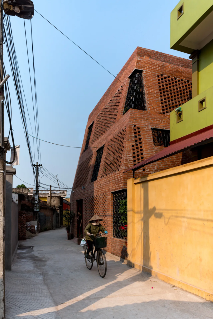
Brick Cave, by Doan Thanh Ha
In Vietnam, bricks have been used for at least a millennium. Doan Thanh Ha, who recently won the Turgut Cansever International Award, constructed the Brick Cave in the suburbs of Hanoi with an additional exterior wall to form a narrow atrium around the house. This perforated exterior casing with large windows invites natural light into the family home while keeping it cool during Hanoi’s scorching summers. The rooftop features a vegetable garden.
Central Park, by LAVA and ASPECT Studio
LAVA and ASPECT Studio won the commission to revamp Ho Chi Minh City’s September 23 Park, one of the city centre’s largest green spaces. As well as outdoor art galleries, performance pavilions and sport zones, LAVA and ASPECT Studio are deploying smart city artificial trees. Water purification trees collect and recycle rainwater, ventilation trees provide fresh air and solar trees generate power. Construction is scheduled to begin later in 2020.
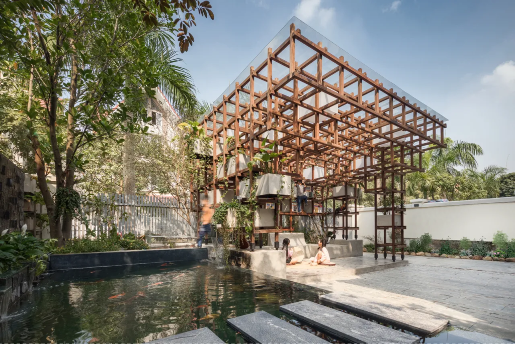
VAC Library, by Farming Architects
While large-scale ventures are making a bold impact, smaller innovations are surfacing more quietly. In Hanoi, VAC Library by Farming Architects (Pictured above) is both climbing frame and reading room set within a three-dimensional grid fashioned from wooden beams. Other small projects of great promise include the Chieng Yen Community House in Son La Province by 1+1>2 Architects, which has a semi-cylindrical thatch roof supported by a bamboo frame. In Danang, architecture studio Tropical Space used brick to construct Cuckoo House, a family home perched above a café.
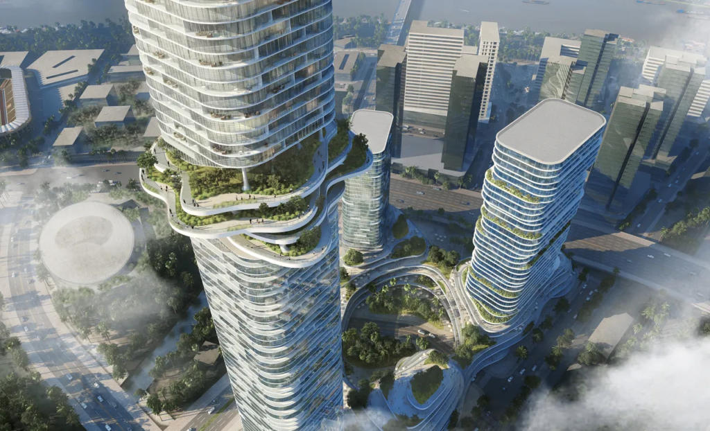
Empire City, by Ole Scheeren
As Vietnam’s commercial capital, Ho Chi Minh City is entertaining many of the country’s most ambitious projects. With Empire City, Ole Scheeren explores how ‘nature can become an iconic element of architecture’ with a complex of three towers overlooking the Saigon River. At the building’s base, layered platforms evoke the swirling rice terraces of northern Vietnam. Over halfway up Empire Tower 88, the tallest of the three skyscrapers at 333 metres, sits the Sky Forest with verdant water gardens that echo the country’s jungles. Construction is expected to start in early 2021.
Next project | C an G io emotional city
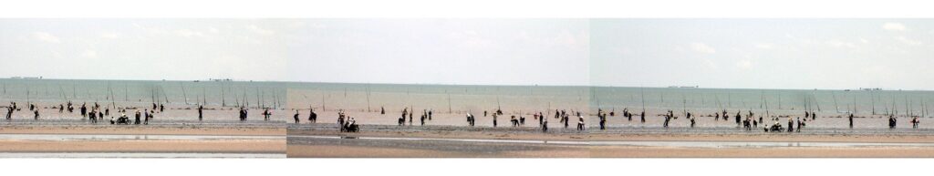
Photo by Vinhho
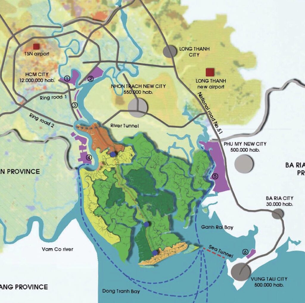
The goal is to enhance connectivity between Can Gio and neighboring provinces, particularly Vung Tau. As Ho Chi Minh City continues to expand, the demand for infrastructure grows, posing potential risks to Can Gio’s ecological integrity. Special attention is given to strengthening links with the nearby beach resort of Vung Tau, initially through a speedboat network and eventually with the proposed construction of an undersea tunnel.
While the jury found the tunnel proposal highly debatable, they acknowledged that the previously approved masterplan lacked adequate provisions for improving these connections. Team 4 prioritized these links, making them a central focus of their proposal.
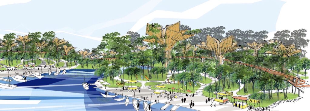
Another key aspect of the development proposed by the team is the diversification of tourism activities. These could range from walking or boating excursions through the mangroves to farm visits, beach activities, and trips to nearby provinces made more accessible through the improved transportation links.
The team also presented a project to reclaim land and create two artificial islands off the coast at the eastern and western ends. These islands are envisioned as hubs for diverse tourism activities, offering unique experiences to visitors.
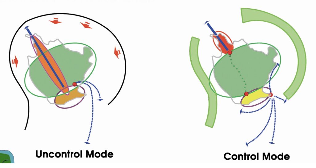
Achieving these objectives will require significant improvements to infrastructure. A high-speed transportation system must be implemented in a way that respects the environment and minimizes pollution, bringing Can Gio closer to nearby development areas.
Freshwater supply is critical for both residents and tourists. A sustainable water collection and recycling system should be established to optimize this valuable resource while preventing water pollution.
The construction of eco-houses will help balance the infrastructural development, ensuring harmony with the natural surroundings. Additionally, all other modes of transportation within the area will be designed to be environmentally friendly.
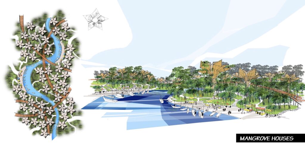
The project seeks to enhance the quality of life for the residents of Can Gio. This will be accomplished by preserving and upgrading traditional activities such as farming and those along the beach.
Locals will be encouraged to participate in service, trade, and production activities to meet the demands of tourism while maintaining their cultural heritage. Traditional practices will be promoted, enabling those living in the forest, on the beach, or along the river to share their unique ways of life.
Additionally, numerous public spaces and recreational activities will be developed, fostering leisure and entertainment opportunities for both residents and visitors.
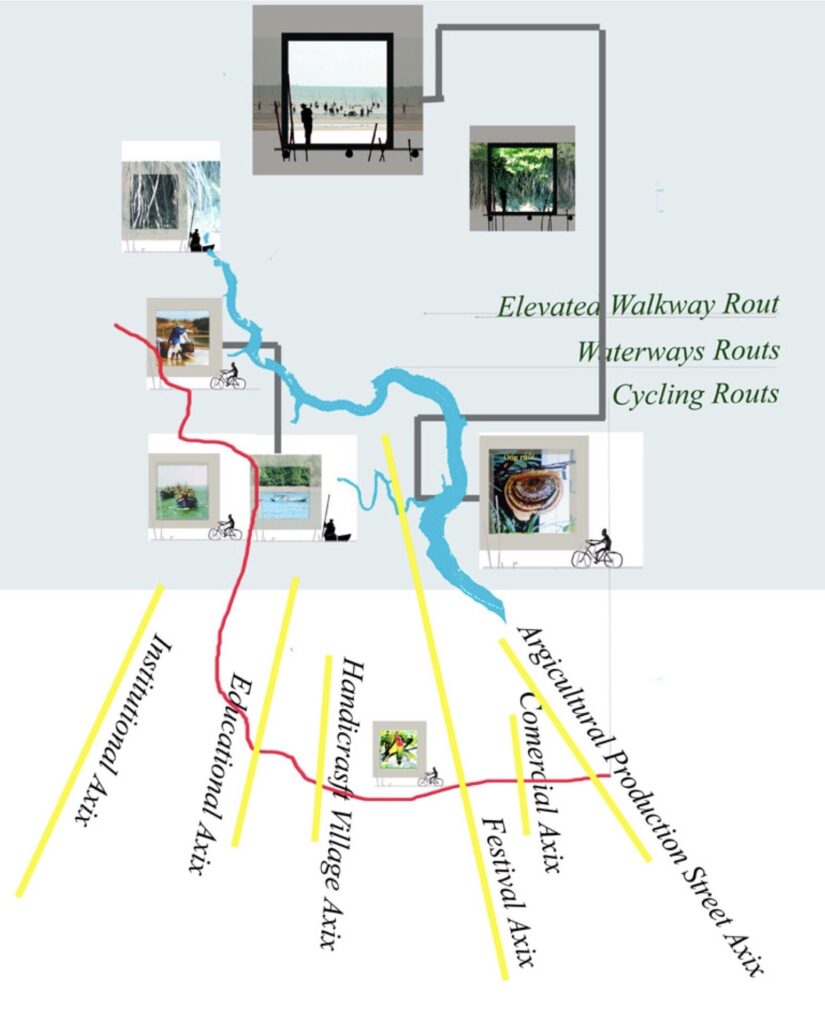
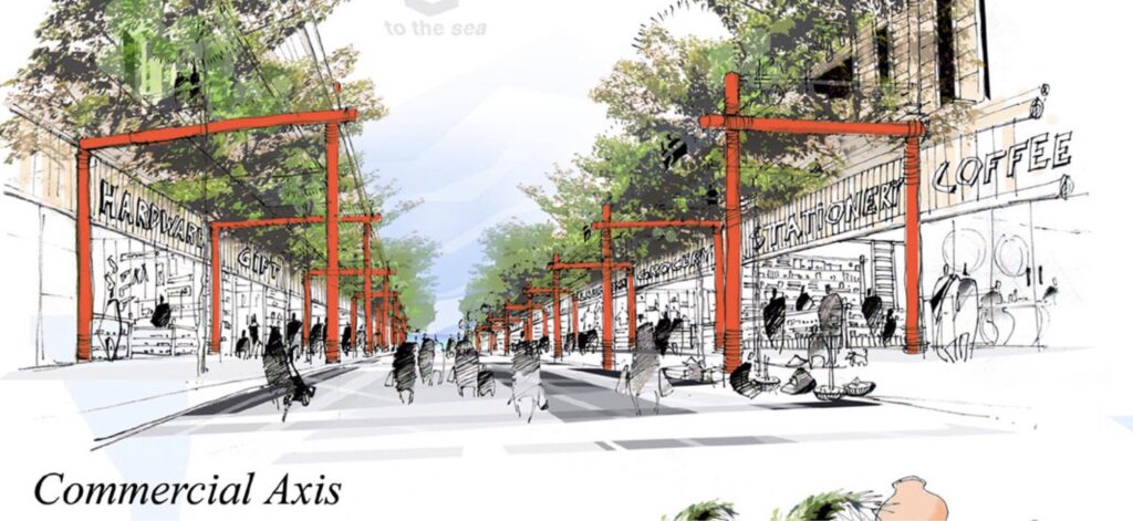
The southern area of Can Gio along the beach will be developed with a focus on preserving the connections between the forest and the sea. Six key axes will serve as the foundation for these links: an agricultural production axis, a commercial axis, a festival axis, a handicraft village axis, a traditional market axis, and a public space axis.
This approach ensures that development respects the natural and cultural heritage of the region while creating vibrant and functional spaces for both residents and visitors.
The ultimate aim of this proposal is to evoke and enrich people’s senses and emotions, creating an “emotional city”. Both visitors and locals will be immersed in a symphony of sensory experiences:
They will listen to the soothing sounds of the forest and the rhythmic waves of the beach. They will marvel at breathtaking views of the sea and lush forests, swim in the waves, and feel the textures of the forest’s natural wonders.
The air will carry the refreshing scent of the sea, mingling with the intricate fragrances of the mangrove. They will savor the local flavors, from seafood harvested from the river and sea to traditional delicacies.
Beyond these sensory delights, their emotions will be further deepened by the rich history, vibrant culture, and timeless traditions of Can Gio, making every moment a journey of discovery and connection.
Team 4
- Ho Viet Vinh – Leader Architect, Urban Planner
- Pham Phu Cuong – Architect
- Nguyen Hong Minh – Architect
- Hoang Anh Tu – Architect, Urban Planner
- Pham Anh Tuan – Architect, Urban Planner
- Nguyen Anh Tuan – Architect, Landscape Architect
Team 4, comprised entirely of Vietnamese professionals and led by Architect Ho Viet Vinh, brought a profound vision for the future of Can Gio. The team outlined a series of key objectives, including the preservation of the mangrove ecosystem—both its core and transitional areas—the optimization and development of local production activities, and the protection of water resources from pollution originating from the Saigon-Dong Nai River and the sea.
For their insightful and forward-thinking approach, Team 4 awarded a special mention from the Workshops of Cergy-Pontoise.
Next project | Lời khuyên cho các Kiến trúc sư trẻ

“Kiến trúc sư cần phát triển khả năng suy nghĩ sáng tạo, đột phá các giới hạn thông thường mà AI có thể khó bắt chước. Các ý tưởng độc đáo, cảm xúc sâu sắc và nghệ thuật trừu tượng luôn khó được mô phỏng bởi AI, vì chúng phụ thuộc nhiều vào trải nghiệm sống và hiểu biết văn hóa của con người.” – KTS Hồ Viết Vinh
Next project | Frank O Gehry (1929-2025)
“Artists dismiss me as an architect, so I am not in their box, and architects dismiss me as an artist, so I’m not in their box. I don’t know whose box I’m in, and I don’t really care.”
Frank O Gehry
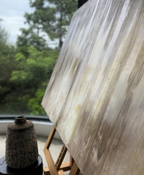
Vinhho, Acrylic on canvas, 100x100cm, Maison d’Art, 2025
Next project | DANCE of LIGHT
The “Dance of light” stirring a feeling of motion and vitality. This interplay between brilliance and obscurity crafts an enigmatic allure, coaxing the observer to explore the depths of light.
Ho Viet Vinh
(Vinhho, Acrylic on canvas, 130x97cm, Maison de Corail.2024)
Next project | HVV Recruitment
HVV Recruitment:
In 2025, HVV is looking to recruit talented individuals for the following positions:
- 2 Urban Planners;
- 2 Landscape Architects;
- 2 Architects specialized in Architecture and Interior Design.
Requirements:
- Bachelor’s degree in a relevant field for each position;
- 2–3 years of work experience;
- Proficiency in commonly used design software, such as ACAD, SU, Lumion, Rhino, 3Dmax,…;
- Skilled in one or more of the following areas: 3D and 2D concept visualization, design implementation, design management;
- A professional attitude, eagerness to learn, creativity, and integrity.
Join us in creating inspiring living spaces that reflect cultural identity!
At HVV, we are not just looking for talented architects but also seeking to collaborate with creative minds who are passionate about innovation and aspire to achieve timeless values. Let your talent bring meaningful projects to life and leave a lasting mark with us.
Contact:
HVV Architect and partners
Architect Ho Viet Vinh
Phone: +84 908 376 727
Email: [email protected]
Join us now to turn unique ideas into reality!